Area Overview for WD18 0DW
Photos of WD18 0DW

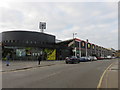
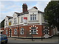
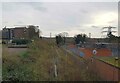
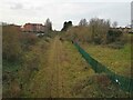
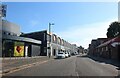
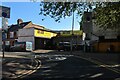
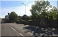
41 photos from this area
Area Information
Key information about the WD18 0DW including its size, population, and administrative classification.
- Area Type
- Postcode
- Area Size
- 1.1 hectares
- Population
- 1742
- Population Density
- 4442 people/km²
House Prices in WD18 0DW
52
Properties
£264,236
Average Sold Price
£57,000
Lowest Price
£450,000
Highest Price
Showing 52 properties
| Address | Type | Beds | Baths | Last Sale Price | Last Sale Date | |
|---|---|---|---|---|---|---|
| 45 Liverpool Road, Watford, WD18 0DW | Terraced | 3 | 1 | £375,000 | May 2025 | |
| 99 Liverpool Road, Watford, WD18 0DW | house | - | - | £350,000 | Feb 2025 | |
| 39 Liverpool Road, Watford, WD18 0DW | Terraced | 4 | 1 | £450,000 | Dec 2023 | |
| 35 Liverpool Road, Watford, WD18 0DW | Terraced | 3 | 1 | £330,000 | Sep 2023 | |
| 17 Liverpool Road, Watford, WD18 0DW | Terraced | 2 | 2 | £385,000 | Aug 2023 | |
| 37 Liverpool Road, Watford, WD18 0DW | Terraced | 2 | 1 | £400,000 | Jul 2023 | |
| 5 Liverpool Road, Watford, WD18 0DW | Retail | 3 | 1 | £430,500 | Dec 2021 | |
| 41 Liverpool Road, Watford, WD18 0DW | Terraced | 2 | 1 | £330,000 | Jan 2021 | |
| 73 Liverpool Road, Watford, WD18 0DW | Terraced | 2 | 1 | £337,500 | Dec 2020 | |
| 85 Liverpool Road, Watford, WD18 0DW | Terraced | 2 | 1 | £340,000 | Nov 2020 |
Page 1 of 6
Energy Efficiency in WD18 0DW
Amenities
Schools
| Rank | School | Type | Entry gender | Ages |
|---|
Explore more schools in this area
Go to Schools tabDemographics
Household Size
Family (3-5 people)
most common
Accommodation Type
Houses
most common
Tenure
47
majority
Ethnic Group
White
most common
Religion
N/A
most common
Household Composition
N/A
most common
Age
47
median
Adults (30-64 years)
most common
Household Deprivation
N/A
with no deprivation
NS-SEC
37
in Lower managerial occupations
Explore more demographic insights in this area
Go to Demographics tabPlanning
Planning Constraints
- Flood RiskPremium
- Ramsar Wetland SitesPremium
- Area of Outstanding Natural BeautyPremium
- Protected Nature ReservePremium
- Protected WoodlandPremium