Area Overview for WD17 4TD
Photos of WD17 4TD
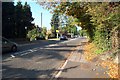
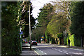
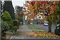
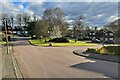
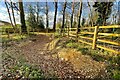
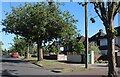
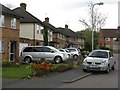

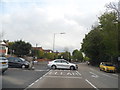
15 photos from this area
Area Information
Key information about the WD17 4TD including its size, population, and administrative classification.
- Area Type
- Postcode
- Area Size
- 1.1 hectares
- Population
- 2133
- Population Density
- 3357 people/km²
House Prices in WD17 4TD
14
Properties
£733,500
Average Sold Price
£583,000
Lowest Price
£985,000
Highest Price
Showing 14 properties
| Address | Type | Beds | Baths | Last Sale Price | Last Sale Date | |
|---|---|---|---|---|---|---|
| 22 Ridge Lane, Watford, WD17 4TD | Detached | 4 | 3 | £840,000 | May 2019 | |
| 6 Ridge Lane, Watford, WD17 4TD | Detached | 4 | 2 | £985,000 | Aug 2018 | |
| 28 Ridge Lane, Watford, WD17 4TD | Detached | 4 | - | £660,000 | Feb 2015 | |
| The Oaks, 2B Ridge Lane, Watford, WD17 4TD | Detached | - | - | £685,000 | Apr 2009 | |
| Ridge View, 2A Ridge Lane, Watford, WD17 4TD | Detached | - | - | £705,000 | Jan 2009 | |
| Birch End, 2 Ridge Lane, Watford, WD17 4TD | Detached | - | - | £775,000 | Jun 2008 | |
| 26 Ridge Lane, Watford, WD17 4TD | Terraced | - | - | £635,000 | May 2008 | |
| 24 Ridge Lane, Watford, WD17 4TD | Terraced | - | - | £583,000 | Dec 2007 | |
| 10 Ridge Lane, Watford, WD17 4TD | Detached | 4 | 3 | - | - | |
| 222 Hempstead Road, Watford, WD17 4TD | Detached | - | - | - | - |
Page 1 of 2
Energy Efficiency in WD17 4TD
Amenities
Schools
| Rank | School | Type | Entry gender | Ages |
|---|
Explore more schools in this area
Go to Schools tabDemographics
Household Size
Family (3-5 people)
most common
Accommodation Type
Houses
most common
Tenure
82
majority
Ethnic Group
White
most common
Religion
N/A
most common
Household Composition
N/A
most common
Age
47
median
Adults (30-64 years)
most common
Household Deprivation
N/A
with no deprivation
NS-SEC
56
in Lower managerial occupations
Explore more demographic insights in this area
Go to Demographics tabPlanning
Planning Constraints
- Flood RiskPremium
- Ramsar Wetland SitesPremium
- Area of Outstanding Natural BeautyPremium
- Protected Nature ReservePremium
- Protected WoodlandPremium