Area Overview for WD17 4SU
Photos of WD17 4SU

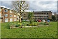
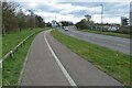
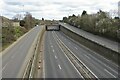
26 photos from this area
Area Information
Key information about the WD17 4SU including its size, population, and administrative classification.
- Area Type
- Postcode
- Area Size
- 4694 m²
- Population
- 2133
- Population Density
- 3357 people/km²
House Prices in WD17 4SU
11
Properties
£568,900
Average Sold Price
£345,000
Lowest Price
£795,000
Highest Price
Showing 11 properties
| Address | Type | Beds | Baths | Last Sale Price | Last Sale Date | |
|---|---|---|---|---|---|---|
| 153 Ridge Lane, Watford, WD17 4SU | Semi-detached | 4 | 2 | £795,000 | Jun 2025 | |
| 159 Ridge Lane, Watford, WD17 4SU | house | 3 | 1 | £637,000 | Nov 2022 | |
| 151 Ridge Lane, Watford, WD17 4SU | Semi-detached | 5 | 3 | £685,000 | Mar 2016 | |
| 147 Ridge Lane, Watford, WD17 4SU | house | - | - | £345,000 | Nov 2012 | |
| 155 Ridge Lane, Watford, WD17 4SU | Terraced | - | - | £382,500 | Oct 2006 | |
| 149 Ridge Lane, Watford, WD17 4SU | Terraced | - | - | - | - | |
| 157 Ridge Lane, Watford, WD17 4SU | Terraced | - | - | - | - | |
| 145 Ridge Lane, Watford, WD17 4SU | house | - | - | - | - | |
| 141 Ridge Lane, Watford, WD17 4SU | Terraced | - | - | - | - | |
| 143 Ridge Lane, Watford, WD17 4SU | Terraced | - | - | - | - |
Page 1 of 2
Energy Efficiency in WD17 4SU
Amenities
Schools
| Rank | School | Type | Entry gender | Ages |
|---|
Explore more schools in this area
Go to Schools tabDemographics
Household Size
Family (3-5 people)
most common
Accommodation Type
Houses
most common
Tenure
82
majority
Ethnic Group
White
most common
Religion
N/A
most common
Household Composition
N/A
most common
Age
47
median
Adults (30-64 years)
most common
Household Deprivation
N/A
with no deprivation
NS-SEC
56
in Lower managerial occupations
Explore more demographic insights in this area
Go to Demographics tabPlanning
Planning Constraints
- Flood RiskPremium
- Ramsar Wetland SitesPremium
- Area of Outstanding Natural BeautyPremium
- Protected Nature ReservePremium
- Protected WoodlandPremium