Area Overview for WD17 4NU
Photos of WD17 4NU

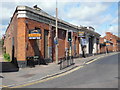

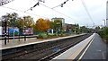
81 photos from this area
Area Information
Key information about the WD17 4NU including its size, population, and administrative classification.
- Area Type
- Postcode
- Area Size
- 1.5 hectares
- Population
- 1679
- Population Density
- 2570 people/km²
House Prices in WD17 4NU
29
Properties
£563,694
Average Sold Price
£112,500
Lowest Price
£1,080,000
Highest Price
Showing 29 properties
| Address | Type | Beds | Baths | Last Sale Price | Last Sale Date | |
|---|---|---|---|---|---|---|
| 71 The Avenue, Watford, WD17 4NU | house | 4 | 2 | £1,065,000 | Jul 2023 | |
| 43 The Avenue, Watford, WD17 4NU | Detached | 5 | 2 | £1,080,000 | Dec 2021 | |
| 39 The Avenue, Watford, WD17 4NU | Detached | 5 | 2 | £835,000 | Jan 2021 | |
| 37A The Avenue, Watford, WD17 4NU | Flat | 2 | 1 | £282,500 | Aug 2017 | |
| 73 The Avenue, Watford, WD17 4NU | Bungalow | - | - | £801,000 | Dec 2016 | |
| 45 The Avenue, Watford, WD17 4NU | Detached | 6 | 2 | £1,010,000 | Feb 2016 | |
| 55 The Avenue, Watford, WD17 4NU | house | 7 | - | £750,000 | Oct 2013 | |
| 47 The Avenue, Watford, WD17 4NU | house | - | - | £746,000 | Aug 2010 | |
| 37 The Avenue, Watford, WD17 4NU | Flat | - | - | £112,500 | Jul 2006 | |
| 35A The Avenue, Watford, WD17 4NU | Maisonette | - | - | £142,000 | Feb 2005 |
Page 1 of 3
Energy Efficiency in WD17 4NU
Amenities
Schools
| Rank | School | Type | Entry gender | Ages |
|---|
Explore more schools in this area
Go to Schools tabDemographics
Household Size
Family (3-5 people)
most common
Accommodation Type
Houses
most common
Tenure
71
majority
Ethnic Group
White
most common
Religion
N/A
most common
Household Composition
N/A
most common
Age
47
median
Adults (30-64 years)
most common
Household Deprivation
N/A
with no deprivation
NS-SEC
46
in Lower managerial occupations
Explore more demographic insights in this area
Go to Demographics tabPlanning
Planning Constraints
- Flood RiskPremium
- Ramsar Wetland SitesPremium
- Area of Outstanding Natural BeautyPremium
- Protected Nature ReservePremium
- Protected WoodlandPremium