Area Overview for WD17 4LX
Photos of WD17 4LX
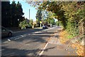
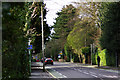
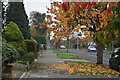
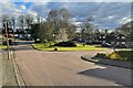

15 photos from this area
Area Information
Key information about the WD17 4LX including its size, population, and administrative classification.
- Area Type
- Postcode
- Area Size
- 5193 m²
- Population
- 2133
- Population Density
- 3357 people/km²
House Prices in WD17 4LX
22
Properties
£211,304
Average Sold Price
£93,500
Lowest Price
£359,000
Highest Price
Showing 22 properties
| Address | Type | Beds | Baths | Last Sale Price | Last Sale Date | |
|---|---|---|---|---|---|---|
| 54 Melrose Place, Watford, WD17 4LX | Flat | 2 | 1 | £280,000 | Nov 2023 | |
| 28 Melrose Place, Watford, WD17 4LX | Maisonette | 2 | 1 | £330,000 | Oct 2022 | |
| 56 Melrose Place, Watford, WD17 4LX | Maisonette | 3 | - | £355,000 | Jun 2021 | |
| 32 Melrose Place, Watford, WD17 4LX | Maisonette | 2 | 1 | £324,000 | Mar 2017 | |
| 24 Melrose Place, Watford, WD17 4LX | Maisonette | 1 | - | £173,000 | Feb 2016 | |
| 44 Melrose Place, Watford, WD17 4LX | Terraced | 3 | 1 | £359,000 | Apr 2015 | |
| 46 Melrose Place, Watford, WD17 4LX | Terraced | 2 | 1 | £272,000 | Feb 2014 | |
| 34 Melrose Place, Watford, WD17 4LX | Maisonette | 2 | 1 | £193,000 | Sep 2013 | |
| 30 Melrose Place, Watford, WD17 4LX | Maisonette | 2 | - | £193,000 | Feb 2011 | |
| 20 Melrose Place, Watford, WD17 4LX | Flat | 2 | 1 | £172,571 | Oct 2007 |
Page 1 of 3
Energy Efficiency in WD17 4LX
Amenities
Schools
| Rank | School | Type | Entry gender | Ages |
|---|
Explore more schools in this area
Go to Schools tabDemographics
Household Size
Family (3-5 people)
most common
Accommodation Type
Houses
most common
Tenure
82
majority
Ethnic Group
White
most common
Religion
N/A
most common
Household Composition
N/A
most common
Age
47
median
Adults (30-64 years)
most common
Household Deprivation
N/A
with no deprivation
NS-SEC
56
in Lower managerial occupations
Explore more demographic insights in this area
Go to Demographics tabPlanning
Planning Constraints
- Flood RiskPremium
- Ramsar Wetland SitesPremium
- Area of Outstanding Natural BeautyPremium
- Protected Nature ReservePremium
- Protected WoodlandPremium