Area Overview for WD17 3HJ
Photos of WD17 3HJ

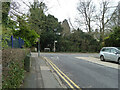
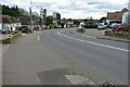
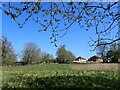
15 photos from this area
Area Information
Key information about the WD17 3HJ including its size, population, and administrative classification.
- Area Type
- Postcode
- Area Size
- 9679 m²
- Population
- 2133
- Population Density
- 3357 people/km²
House Prices in WD17 3HJ
11
Properties
£690,995
Average Sold Price
£235,000
Lowest Price
£1,100,000
Highest Price
Showing 11 properties
| Address | Type | Beds | Baths | Last Sale Price | Last Sale Date | |
|---|---|---|---|---|---|---|
| 238 Hempstead Road, Watford, WD17 3HJ | Semi-detached | 4 | 2 | £850,000 | Mar 2025 | |
| 254 Hempstead Road, Watford, WD17 3HJ | Detached | 5 | 2 | £1,100,000 | Oct 2024 | |
| 252 Hempstead Road, Watford, WD17 3HJ | Detached | 3 | 1 | £795,000 | May 2020 | |
| 256 Hempstead Road, Watford, WD17 3HJ | Detached | 5 | 3 | £1,050,000 | Feb 2018 | |
| 240 Hempstead Road, Watford, WD17 3HJ | Detached | 4 | - | £750,000 | Jul 2014 | |
| 236 Hempstead Road, Watford, WD17 3HJ | house | 3 | - | £465,000 | Jan 2013 | |
| 250 Hempstead Road, Watford, WD17 3HJ | Terraced | - | - | £550,000 | Jun 2007 | |
| 246 Hempstead Road, Watford, WD17 3HJ | Terraced | - | - | £624,950 | Aug 2006 | |
| 244 Hempstead Road, Watford, WD17 3HJ | Terraced | - | - | £490,000 | Feb 2006 | |
| 248 Hempstead Road, Watford, WD17 3HJ | Flat | 3 | - | £235,000 | Apr 1999 |
Page 1 of 2
Energy Efficiency in WD17 3HJ
Amenities
Schools
| Rank | School | Type | Entry gender | Ages |
|---|
Explore more schools in this area
Go to Schools tabDemographics
Household Size
Family (3-5 people)
most common
Accommodation Type
Houses
most common
Tenure
82
majority
Ethnic Group
White
most common
Religion
N/A
most common
Household Composition
N/A
most common
Age
47
median
Adults (30-64 years)
most common
Household Deprivation
N/A
with no deprivation
NS-SEC
56
in Lower managerial occupations
Explore more demographic insights in this area
Go to Demographics tabPlanning
Planning Constraints
- Flood RiskPremium
- Ramsar Wetland SitesPremium
- Area of Outstanding Natural BeautyPremium
- Protected Nature ReservePremium
- Protected WoodlandPremium