Area Overview for WD17 2PE
Photos of WD17 2PE
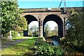

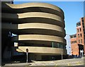


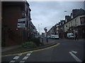


100 photos from this area
Area Information
Key information about the WD17 2PE including its size, population, and administrative classification.
- Area Type
- Postcode
- Area Size
- 3282 m²
- Population
- 1668
- Population Density
- 10761 people/km²
House Prices in WD17 2PE
29
Properties
£314,361
Average Sold Price
£60,000
Lowest Price
£448,000
Highest Price
Showing 29 properties
| Address | Type | Beds | Baths | Last Sale Price | Last Sale Date | |
|---|---|---|---|---|---|---|
| 33 Loates Lane, Watford, WD17 2PE | Terraced | 2 | 1 | £398,000 | Jun 2023 | |
| 37 Loates Lane, Watford, WD17 2PE | Retail | 2 | 2 | £440,000 | Dec 2022 | |
| 26 Loates Lane, Watford, WD17 2PE | house | 2 | - | £448,000 | Sep 2021 | |
| 39 Loates Lane, Watford, WD17 2PE | house | 2 | - | £345,000 | Jan 2018 | |
| 24 Loates Lane, Watford, WD17 2PE | Terraced | 2 | - | £335,000 | Aug 2015 | |
| 22 Loates Lane, Watford, WD17 2PE | Terraced | 2 | 1 | £330,000 | Jul 2015 | |
| 41 Loates Lane, Watford, WD17 2PE | Terraced | 2 | - | £235,000 | Dec 2013 | |
| 31 Loates Lane, Watford, WD17 2PE | Terraced | 2 | 1 | £238,250 | Nov 2013 | |
| 35 Loates Lane, Watford, WD17 2PE | Terraced | - | - | £60,000 | Dec 2001 | |
| Flat 4, Emerald Court, 32 Loates Lane, Watford, WD17 2PE | Flat | 2 | 2 | - | - |
Page 1 of 3
Energy Efficiency in WD17 2PE
Amenities
Schools
| Rank | School | Type | Entry gender | Ages |
|---|
Explore more schools in this area
Go to Schools tabDemographics
Household Size
Two person
most common
Accommodation Type
Flats
most common
Tenure
33
majority
Ethnic Group
White
most common
Religion
N/A
most common
Household Composition
N/A
most common
Age
47
median
Adults (30-64 years)
most common
Household Deprivation
N/A
with no deprivation
NS-SEC
38
in Lower managerial occupations
Explore more demographic insights in this area
Go to Demographics tabPlanning
Planning Constraints
- Flood RiskPremium
- Ramsar Wetland SitesPremium
- Area of Outstanding Natural BeautyPremium
- Protected Nature ReservePremium
- Protected WoodlandPremium