Area Overview for WD17 1NA
Photos of WD17 1NA
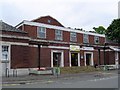
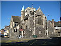
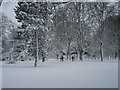

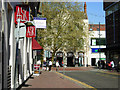
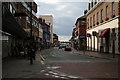
99 photos from this area
Area Information
Key information about the WD17 1NA including its size, population, and administrative classification.
- Area Type
- Postcode
- Area Size
- 1.0 hectares
- Population
- 1066
- Population Density
- 8501 people/km²
House Prices in WD17 1NA
10
Properties
£282,500
Average Sold Price
£165,000
Lowest Price
£400,000
Highest Price
Showing 10 properties
| Address | Type | Beds | Baths | Last Sale Price | Last Sale Date | |
|---|---|---|---|---|---|---|
| 145A The Parade High Street, Watford, WD17 1NA | Flat | 2 | - | £400,000 | Apr 2022 | |
| 141A The Parade High Street, Watford, WD17 1NA | Maisonette | 3 | 2 | £165,000 | Oct 2012 | |
| 147A The Parade High Street, Watford, WD17 1NA | Flat | 1 | 1 | - | - | |
| Flat 1, 143A The Parade High Street, Watford, WD17 1NA | Flat | 2 | 1 | - | - | |
| Flat 2, 143A The Parade High Street, Watford, WD17 1NA | retail_financial | - | - | - | - | |
| Tops Pizza, 155 The Parade High Street, Watford, WD17 1NA | Restaurant | - | - | - | - | |
| Brown & Emery Solicitors, 151-153 The Parade High Street, Watford, WD17 1NA | Office | - | - | - | - | |
| 147B The Parade High Street, Watford, WD17 1NA | Flat | - | - | - | - | |
| Libor Room The Old Bank, First Floor, 153 The Parade High Street, Watford, WD17 1NA | Office | - | - | - | - | |
| First Floor, 153 The Parade High Street, Watford, WD17 1NA | Office | - | - | - | - |
Energy Efficiency in WD17 1NA
Amenities
Schools
| Rank | School | Type | Entry gender | Ages |
|---|
Explore more schools in this area
Go to Schools tabDemographics
Household Size
One person
most common
Accommodation Type
Flats
most common
Tenure
24
majority
Ethnic Group
White
most common
Religion
N/A
most common
Household Composition
N/A
most common
Age
47
median
Adults (30-64 years)
most common
Household Deprivation
N/A
with no deprivation
NS-SEC
39
in Lower managerial occupations
Explore more demographic insights in this area
Go to Demographics tabPlanning
Planning Constraints
- Flood RiskPremium
- Ramsar Wetland SitesPremium
- Area of Outstanding Natural BeautyPremium
- Protected Nature ReservePremium
- Protected WoodlandPremium