Area Overview for Warham
Photos of Warham
Area Information
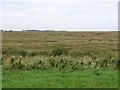
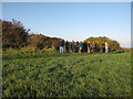
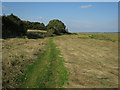
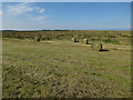
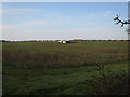
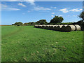
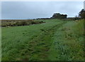
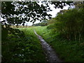
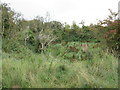
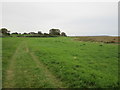
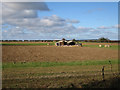
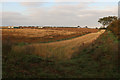
Warham is a civil parish covering an area of 18.9 km² in Norfolk. It represents a setting where residents find a rural lifestyle within a defined local community. The geography of this parish means you will encounter significant environmental designations that shape development and scenery. Living in Warham places you within an Area of Outstanding Natural Beauty, a status that ensures the landscape remains protected from intensive building. You must also navigate the practicalities of this location, as the area contains protected nature reserves and Ramsar wetland sites. These features define the character of the neighbourhood but also impose constraints on planning applications. Daily life here revolves around appreciating the natural environment while managing proximity to these protected zones. The distinct climate and topography influence how you experience the parish on a daily basis. You are surrounded by land that holds specific conservation importance, which is a key consideration for anyone new to the region. The physical boundaries of this 18.9 km² parish create a tight-knit feel compared to larger urban districts. Your access to amenities will depend on your specific location within this rural settlement. The planning constraints associated with the locally cherished environment are a permanent feature of life here. Understanding the balance between open space and land use is essential when settling into Warham.
- Area Type
- Parish
- Area Size
- 18.9 km²
- Population
- Not available
- Population Density
- Not available
Demographics
The community profile of Warham reflects an older demographic compared to the national average. The median age for residents is 70 years, indicating that the population consists primarily of retirees or older adults. When you consider living in Warham, you should expect a neighbourhood where the majority of households contain older individuals. The home ownership rate stands at 39%, which suggests that a significant portion of the population remains in the rental market despite the advanced age profile. This statistic implies that many older residents may not have purchased their current properties. Household composition data is recorded for the total population, providing a baseline for how families and groups occupy homes in the parish. While specific breakdowns for accommodation types and predominant ethnic groups are available in the total record, the snapshot highlights the age as the defining characteristic. You will find a community where age dictates social patterns, from local gatherings to service demands. The low home ownership figure is a notable economic feature that distinguishes this market from areas dominated by outright owners. This dynamic can influence local investment levels and the stability of the resident population over time.
Household Size
Accommodation Type
Tenure
Ethnic Group
Religion
Household Composition
Age
Household Deprivation
NS-SEC
Explore more demographic insights in this area
Go to Demographics tabPlanning
Planning Constraints
- Flood RiskPremium
- Ramsar Wetland SitesPremium
- Area of Outstanding Natural BeautyPremium
- Protected Nature ReservePremium
- Protected WoodlandPremium
- Crime RiskPremium