Area Overview for Waresley
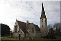
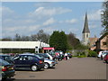
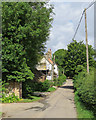
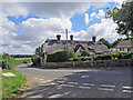
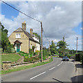
Photos of Waresley

Area Information
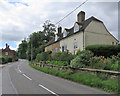
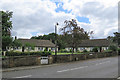
Waresley is a compact built-up area spanning 31 hectares, nestled in England. Its small size means the community feels close-knit, with services and amenities within easy reach. The area’s demographic profile is distinctive: the median age is 70, suggesting a population skewed towards older residents. This is reflected in the high home ownership rate of 84%, indicating a stable, long-term presence of residents. Daily life in Waresley is shaped by its proximity to retail and transport hubs. Within practical walking or driving distance, residents can access five retail outlets, including Co-op Gamlingay and Tesco Potton, alongside two railway stations at St Neots and Sandy. These connections make commuting or short trips straightforward. The area’s character is defined by its quiet, established nature, with a focus on local amenities rather than sprawling development. For those seeking a settled environment with accessible services, Waresley offers a blend of simplicity and convenience.
- Area Type
- Built Up Area 250
- Area Size
- 31.0 hectares
- Population
- Not available
- Population Density
- Not available
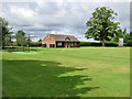
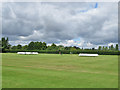
Waresley’s lifestyle is shaped by its proximity to essential amenities. Within practical reach are five retail outlets, including Co-op Gamlingay and Tesco Potton, offering everyday shopping needs. These stores provide convenience for groceries, household items, and other essentials, reducing the need for long trips. The two railway stations at St Neots and Sandy add to the area’s accessibility, enabling easy travel to nearby towns for leisure, work, or social activities. While the data does not specify parks or recreational spaces, the presence of retail and transport hubs suggests a focus on functional living rather than expansive leisure facilities. The area’s character is defined by its practicality, with services clustered to support daily life. Residents can enjoy a self-contained environment where necessities are close at hand, though those seeking extensive green spaces may need to look beyond Waresley.
Amenities
Schools
| Rank | School | Type | Entry gender | Ages |
|---|
Explore more schools in this area
Go to Schools tabDemographics
The population of Waresley has a median age of 70, placing it well above the national average. This suggests a community dominated by older adults, likely retired or semi-retired individuals. The home ownership rate of 84% is notably high, implying that most residents live in properties they own rather than rent. This contrasts with areas where rental markets dominate. The data does not specify household types or ethnic diversity, but the high ownership figure indicates a population that values stability and long-term investment in property. The accommodation types are listed as total, but the high ownership rate suggests a mix of family homes and single-occupancy properties. The lack of specific figures on deprivation or diversity means these aspects cannot be assessed, but the age profile and ownership statistics point to a mature, settled community with a focus on residential permanence.
Household Size
Accommodation Type
Tenure
Ethnic Group
Religion
Household Composition
Age
Household Deprivation
NS-SEC
Explore more demographic insights in this area
Go to Demographics tabPlanning
Planning Constraints
- Crime RiskPremium