Area Overview for Wantisden
Photos of Wantisden


Area Information
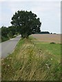
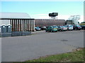
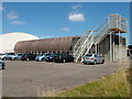
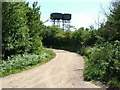
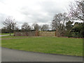
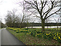
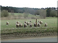
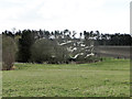
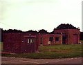
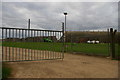
Wantisden is a civil parish situated within Suffolk Coastal, extending across 8.6 square kilometres. This village maintains a distinct connection to its regional history while functioning as a quiet settlement in East Suffolk. The area lies approximately six miles east-north-east of Woodbridge and just three miles south-east of the Wickham-Market railway junction. You will find the parish deeply rooted in the past, with landmarks dating back to medieval times. The community is defined by its proximity to Tunstall Forest and its significant historical tie to the former USAAF Bentwaters airbase. Today, the site of that massive military expansion houses warehousing and storage facilities, a stark reminder of the Second World War period when the entire area was requisitioned. You can still see the marks of that era, including cracks remaining in St. John the Baptist Church walls from damage sustained decades ago. The church itself stands as the parish's principal landmark, located in fields about half a mile from the nearest road. For those considering living in Wantisden, the environment offers a specific kind of rural seclusion where history intersects with the quiet rhythm of daily life.
- Area Type
- Parish
- Area Size
- 8.6 km²
- Population
- Not available
- Population Density
- Not available
Demographics
The community profile of Wantisden reveals a settlement dominated by older residents. The median age stands at 70 years, with the data indicating Age: Total as the most common grouping in the demographic breakdown. You are more likely to encounter long-term residents here than a transient population of young families. Home ownership is prevalent, accounting for 74% of households in the parish. This high rate suggests a stable community where many residents have put down roots for decades. While specific data on household composition is not detailed in the provided records, the focus on ownership and age implies a neighbourhood character aligned with retiring or established populations. There is no breakdown provided for the predominant ethnic group or religious affiliation, so the diversity profile remains unquantified by the available figures. However, the clear majority ownership and senior median age paint a picture of a contained, settled village. When you think about buying a home here, you are joining a demographic where permanence outweighs mobility. The statistics reflect a community where people choose to stay, evidenced by the high proportion of owner-occupied dwellings.
Household Size
Accommodation Type
Tenure
Ethnic Group
Religion
Household Composition
Age
Household Deprivation
NS-SEC
Explore more demographic insights in this area
Go to Demographics tabPlanning
Planning Constraints
- Flood RiskPremium
- Ramsar Wetland SitesPremium
- Area of Outstanding Natural BeautyPremium
- Protected Nature ReservePremium
- Protected WoodlandPremium
- Crime RiskPremium