Area Overview for Waldringfield
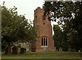
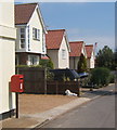
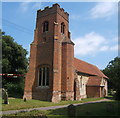
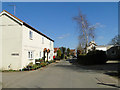
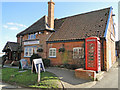
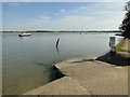
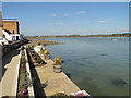
Photos of Waldringfield


Area Information
Waldringfield is a compact built-up area covering 42.5 hectares, nestled in the heart of England. With a median age of 70, it reflects a community shaped by long-term residents, many of whom own their homes—78% of households are owner-occupied. Daily life here is defined by proximity to essential services and transport links. The area’s small size means amenities are within practical reach, from local shops to railway stations. While it lacks the density of larger towns, its quiet character suits those seeking a settled, low-maintenance lifestyle. The presence of Waldringfield Primary School and nearby ferry services adds to its appeal for families and commuters. For buyers, this area offers a mix of stability and convenience, though its older demographic suggests a focus on established communities rather than rapid growth.
- Area Type
- Built Up Area 250
- Area Size
- 42.5 hectares
- Population
- Not available
- Population Density
- Not available
Waldringfield’s lifestyle is shaped by its proximity to essential amenities. Within practical reach are five retail outlets, including Aldi Gloster and Tesco Martlesham, offering everyday shopping convenience. The area’s railway stations, such as Entrance2 and Woodbridge, provide easy access to nearby towns, while ferry services like Bawdsey Ferry Landing add alternative transport options. Though the data does not list parks or leisure facilities explicitly, the presence of multiple retail and transport hubs suggests a functional, if modest, lifestyle. For residents, this means a balance of local convenience and regional connectivity, though the absence of detailed information on leisure options means further exploration is needed to fully assess the area’s character.
Amenities
Schools
The nearest school to Waldringfield is Waldringfield Primary School, which serves the local community. Its Ofsted rating is satisfactory, indicating it meets basic standards but may not excel in areas like academic performance or pastoral care. As a primary school, it caters to younger children, though the absence of secondary education options within the area means families may need to look further afield for comprehensive schooling. The single school listed suggests limited choice for parents, though the satisfactory rating ensures a baseline level of education quality. For those prioritising proximity to schools, this is a key consideration, though additional research would be needed to evaluate broader educational opportunities in the region.
| Rank | School | Type | Entry gender | Ages |
|---|
Explore more schools in this area
Go to Schools tabDemographics
Waldringfield’s population skews heavily towards older adults, with a median age of 70. This indicates a community where retirement is the norm, and household composition likely reflects this, with fewer young families. Home ownership is high at 78%, suggesting a stable housing market with limited rental activity. The data does not specify accommodation types or diversity metrics, but the absence of detailed breakdowns implies a uniformity in housing stock and demographics. While the area’s age profile may limit opportunities for younger residents, it also contributes to a tranquil environment with fewer transient populations. The lack of specific figures on deprivation or diversity means the area’s quality of life remains largely unquantified, though the low crime risk and practical amenities suggest a functional, if unremarkable, living experience.
Household Size
Accommodation Type
Tenure
Ethnic Group
Religion
Household Composition
Age
Household Deprivation
NS-SEC
Explore more demographic insights in this area
Go to Demographics tabPlanning
Planning Constraints
- Crime RiskPremium