Area Overview for Upton with Fishley
Photos of Upton with Fishley
Area Information
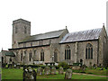
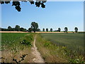
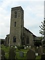
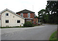
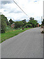
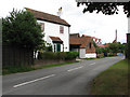
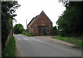
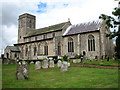
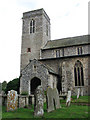
Upton with Fishley is a small civil parish located in England covering an area of 8.9 square kilometres. The landscape and character of this parish define daily life for its residents, who operate within a distinct local community. Living in Upton with Fishley involves navigating a rural setting with specific environmental features that influence the area. The parish is not situated within an Area of Outstanding Natural Beauty, yet it does contain significant protected natural sites. A considerable portion of the land contains Ramsar wetland sites along with designated protected nature reserves. These environmental designations impose planning constraints on development and shape the visual character of the neighbourhood. You will find that the daily rhythm here is closely tied to these natural boundaries rather than urban infrastructure. The small geographic size means distances between homes and amenities are relatively short, fostering a tight-knit environment. However, the presence of sensitive habitats means that new building schemes face stricter scrutiny than in other rural locations. This balance between conservation and habitation creates a specific atmosphere for those considering homes in Upton with Fishley. The parish offers a defined space where nature and residence intersect directly. Prospective buyers must understand that the local planning framework prioritises the preservation of these wetlands and nature reserves above expansion. This reality shapes every aspect of living here, from garden boundaries to future community growth. The parish stands as a distinct entity defined by its ecological importance and rural scale.
- Area Type
- Parish
- Area Size
- 8.9 km²
- Population
- Not available
- Population Density
- Not available
Demographics
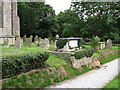
The community profile of Upton with Fishley reveals a very specific age demographic with a median age of 70 years. This figure indicates that the population skews heavily towards older residents compared to national averages. The data categorises the most common age range simply as total, suggesting a broad distribution within that senior cohort rather than a concentration in a single narrow bracket. This demographic structure implies that services and local amenities cater primarily to the needs of an older population. Household data shows that 75% of residents own their homes outright or through a mortgage. This high level of home ownership suggests a settled population rather than a transient rental market. Accommodation types in the parish reflect this stability, though specific breakdowns between detached, semi-detached, and terraced housing are not detailed in the available statistics. The diversity of the ethnic group and the religious composition of the parish are noted as totals in the records. While the data does not provide granular breakdowns for these categories, the overall picture points to a traditional, established community. The absence of significant younger age groups suggests limited school-age children currently residing in parish boundaries. This demographic reality means social life revolves around retirement communities, elderly clubs, and inter-generational family gatherings. Homes in Upton with Fishley are built for long-term occupancy by those approaching or in retirement. The community feel is directly shaped by this older median age, creating a quiet, settled environment with specific social dynamics.
Household Size
Accommodation Type
Tenure
Ethnic Group
Religion
Household Composition
Age
Household Deprivation
NS-SEC
Explore more demographic insights in this area
Go to Demographics tabPlanning
Planning Constraints
- Flood RiskPremium
- Ramsar Wetland SitesPremium
- Area of Outstanding Natural BeautyPremium
- Protected Nature ReservePremium
- Protected WoodlandPremium
- Crime RiskPremium