Area Overview for Ulting
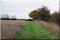
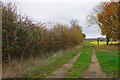
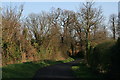
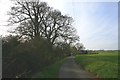
Photos of Ulting
Area Information
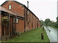
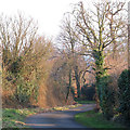
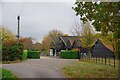
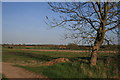
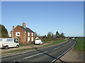
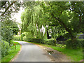
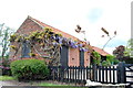
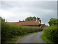
Ulting is a small rural civil parish located in the Maldon district of Essex, covering a total area of 4.2 square kilometres. You will find this village situated a few miles northwest of Maldon, close to the banks of the River Chelmer. The community consists of 166 residents according to the 2021 census, creating a very quiet and intimate living environment. This historic settlement was first mentioned in the Domesday Book, where it supported around 150 people and included woodland and two mills. Today, the village retains its agricultural character, with the main occupation still rooted in farming and small home-based businesses such as garden design. Daily life here revolves around a tranquil pace, defined by the presence of Ulting Wick garden and the canalised River Chelmer, which is used for boating and angling. You will find key landmarks including the 12th-century All Saints Church and the site of England's first sugar beet factory. The area borders Langford and Nounsley, forming part of the Langford and Ulting grouped parish council. While the village centre is tiny and scattered across lanes about two miles south of the B1019 road, the proximity to Maldon offers access to local amenities. Living in Ulting means embracing a lifestyle steeped in history, where the quiet charm of ancient settlements meets the practical reality of a modern, albeit small, rural community.
- Area Type
- Parish
- Area Size
- 4.2 km²
- Population
- Not available
- Population Density
- Not available
Demographics
The community in Ulting is defined by an older demographic profile, with a median age of 70 years. This indicates that the population is largely composed of mature adults and retirees rather than families with young children or young professionals. You will encounter very few residents in the standard 20-44 age bracket, which contrasts sharply with more dynamic urban or suburban locations. The village has a very high rate of home ownership, with 84 percent of residents owning their property outright or with a mortgage. This high ownership figure suggests long-term stability within the neighbourhood and a community where families have put deep roots down. Household composition reflects the age profile, with most homes likely occupied by singles, couples without children, or older generations living alone. The accommodation stock is traditional, fitting the character of a village that was holding by Ralph Baynard in the time of the Domesday Book. While specific statistics on ethnicity and religion are not detailed in the current dataset, the dominant demographic trends point to a homogenous, settlement-focused population. For anyone considering buying homes in Ulting, the owner-occupied nature of the area offers reassurance of a settled, low-turnover environment. However, the lack of younger residents might impact local services or the vibrancy of social groups during weekday hours.
Household Size
Accommodation Type
Tenure
Ethnic Group
Religion
Household Composition
Age
Household Deprivation
NS-SEC
Explore more demographic insights in this area
Go to Demographics tabPlanning
Planning Constraints
- Flood RiskPremium
- Ramsar Wetland SitesPremium
- Area of Outstanding Natural BeautyPremium
- Protected Nature ReservePremium
- Protected WoodlandPremium
- Crime RiskPremium