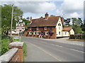
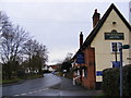
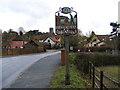
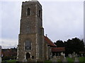
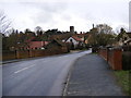
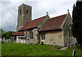
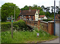
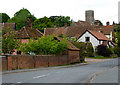
Area Overview for Tuddenham St Martin
Photos of Tuddenham St Martin


Area Information
Living in Tuddenham St Martin offers a distinct blend of compact urban living and community-centric amenities. Covering 30.9 hectares, this built-up area in England is characterised by its older demographic, with a median age of 70. The population, though not explicitly stated, reflects a community where home ownership is high—82% of residents live in their own homes. This suggests a stable, long-term resident base. Daily life here is shaped by proximity to essential services, including five nearby railway stations such as Westerfield Railway Station, which connect residents to broader regional networks. Retail options are also accessible, with multiple branches of the East of England Co-operative Co within practical reach. While the area’s small size means it is not sprawling, its density supports a tight-knit environment where amenities are within walking or short-driving distance. For those seeking a quieter, less congested setting with a strong sense of local identity, Tuddenham St Martin provides a foundation of practicality and familiarity.
- Area Type
- Built Up Area 250
- Area Size
- 30.9 hectares
- Population
- Not available
- Population Density
- Not available
Residents of Tuddenham St Martin have access to a range of amenities within practical reach, enhancing daily life. The five nearby railway stations, including Westerfield Railway Station, provide straightforward connections to regional transport hubs, facilitating both commuting and weekend travel. Retail options are abundant, with multiple branches of the East of England Co-operative Co offering essential shopping needs. While the area’s compact size means fewer expansive parks or leisure facilities, the proximity to retail and rail suggests a lifestyle focused on convenience and accessibility. The presence of multiple retail outlets indicates a community that values local commerce, with shops likely serving both daily necessities and social hubs. For those prioritising ease of access to transport and basic services, Tuddenham St Martin delivers a functional, if modest, lifestyle that caters to practical living needs.
Amenities
Schools
| Rank | School | Type | Entry gender | Ages |
|---|
Explore more schools in this area
Go to Schools tabDemographics
The community in Tuddenham St Martin is predominantly older, with a median age of 70, reflecting a population that skews toward retirement or long-term residency. The most common age range is listed as "Age: Total," suggesting that the data aggregates all age groups, but the high median age indicates a significant proportion of residents are over 65. Home ownership is robust, with 82% of households owning their homes, a figure that suggests a settled, less transient population. Accommodation types and household compositions are not specified in the data, but the high home ownership rate implies a mix of family homes and single-occupancy properties. Diversity metrics, including ethnic groups and religious affiliations, are not provided, so their influence on the area’s social fabric remains unquantified. The absence of specific deprivation data means the quality of life cannot be assessed in terms of economic hardship, but the high home ownership and low crime risk suggest a relatively stable socioeconomic environment.