Area Overview for Troston
Photos of Troston

Area Information
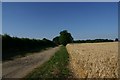
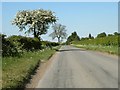
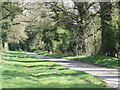
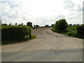
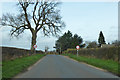
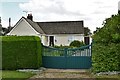
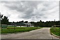
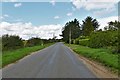
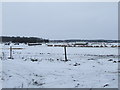
Living in Troston defines a very different pace of life compared to London or major English cities. This civil parish covers 7.3 square kilometres and sits within a landscape characterised by quiet rural living rather than urban density. The area is distinct because it is almost entirely detached from the fast-paced commuter environment, offering a sanctuary for those seeking solitude over convenience. While the location lacks the immediate infrastructure of larger towns, it provides a genuine retreat from city noise and congestion. Residents here enjoy expansive outdoor spaces and open countryside that stretch across the parish boundaries. Daily life in Troston revolves around the natural setting rather than commercial bustle. The lack of significant planning constraints means the built environment remains modest and integrated with the surrounding land. You will find little traffic congestion or crowded public spaces, which creates a tranquil atmosphere suitable for contemplation and outdoor activities. The parish serves as a self-contained rural community where the focus is on preserving the character of the land rather than rapid development. This setting appeals to individuals who prioritise peace and quiet above all else. The area's identity is firmly rooted in its status as a traditional countryside settlement. There are no large retail parks or major employment hubs within Troston itself. Instead, the local economy likely relies on agriculture, tourism, and remote work facilitated by nearby infrastructure. The overall vibe is one of exclusivity achieved through privacy and isolation rather than high property values or exclusive neighbourhood branding. If you value undisturbed surroundings and a direct connection to the English countryside, Troston represents a unique opportunity to establish a home in a truly quiet parish.
- Area Type
- Parish
- Area Size
- 7.3 km²
- Population
- Not available
- Population Density
- Not available
Demographics
The community in Troston presents a distinctly mature profile that sets it apart from many other residential areas. The median age here stands at 70 years, indicating a population skews heavily towards the elderly. This demographic reality shapes the daily rhythm of the parish, creating an environment where quiet evenings and slow-paced days are the norm. The most common age range covers the total population, underscoring that most residents fall into older brackets rather than working-age demographics. Families with young children are a rarity compared to the prevalence of retirees and older couples. Home ownership levels contribute significantly to the stability of the community. Just over 54% of households own their properties outright. This figure suggests a significant portion of the population has achieved financial independence, allowing them to settle comfortably for extended periods. The remaining households likely consist of long-term renters or those purchasing with assistance, though the data does not specify rental figures. The high ownership rate correlates with the older age profile, as retired individuals often retain property ownership throughout their later years. Household composition in Troston reflects these demographic trends. There are very few young adults or single-person households typical of newer urban developments. Instead, living arrangements likely centre around generations cohabiting or older couples with adult children. The accommodation types available align with this, favouring detached or semi-detached family homes rather than high-density flats. Diversity within the ethnic groups and religious makeup is not highlighted in the available statistics, suggesting the community may remain relatively homogenous and traditional. Such a settled demographic creates a predictable and stable environment for those who value consistency over diversity.
Household Size
Accommodation Type
Tenure
Ethnic Group
Religion
Household Composition
Age
Household Deprivation
NS-SEC
Explore more demographic insights in this area
Go to Demographics tabPlanning
Planning Constraints
- Flood RiskPremium
- Ramsar Wetland SitesPremium
- Area of Outstanding Natural BeautyPremium
- Protected Nature ReservePremium
- Protected WoodlandPremium
- Crime RiskPremium