Area Overview for Thundridge and Wadesmill
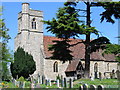
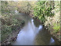
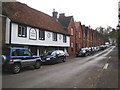
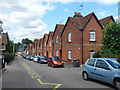
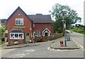
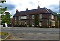
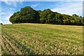
Photos of Thundridge and Wadesmill

Area Information
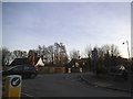
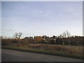
Thundridge and Wadesmill is a compact built-up area in England, covering 38.4 hectares. Its population is characterised by a median age of 70, suggesting a community skewed towards older residents. The area’s small size means it is likely a tight-knit neighbourhood, with local amenities and services accessible within a short distance. Home ownership is high, with 75% of properties owner-occupied, indicating a stable residential base. Living here offers proximity to retail outlets such as Spar, Asda Ware, and Tesco Ware, as well as rail connections to Ware, Hertford East, and St Margarets stations. The area’s safety score of 71, classified as low risk, adds to its appeal. For those seeking a quieter, established environment with practical infrastructure, Thundridge and Wadesmill provides a blend of convenience and security. Its proximity to rail networks and high broadband scores also support both daily living and remote work. While the demographic data shows a mature population, the area’s amenities and transport links make it suitable for those prioritising accessibility and stability.
- Area Type
- Built Up Area 250
- Area Size
- 38.4 hectares
- Population
- Not available
- Population Density
- Not available
The lifestyle in Thundridge and Wadesmill is shaped by its proximity to essential amenities. Within practical reach are five retail outlets, including Spar, Asda Ware, and Tesco Ware, offering everyday shopping needs. The rail stations at Ware, Hertford East, and St Margarets provide access to broader transport networks, enabling easy travel to nearby towns. While the data does not mention parks or leisure facilities, the availability of retail and transport options suggests a practical, convenience-focused environment. The area’s compact size means residents can access services without long commutes. For those valuing accessibility over expansive recreational spaces, Thundridge and Wadesmill offers a straightforward, functional lifestyle. The presence of a primary school and rail links further supports families and commuters, reinforcing the area’s appeal for those prioritising ease of access.
Amenities
Schools
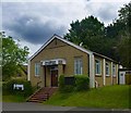
The nearest school to Thundridge and Wadesmill is Thundridge Church of England Primary School, which serves the local community with a primary education offering. It holds a good Ofsted rating, indicating a satisfactory standard of teaching and facilities. The presence of a primary school suggests the area is suitable for families with young children, though no secondary schools are listed in the data. The single school in the area may mean that students attend institutions further afield, but the good rating at the primary level provides reassurance for parents. For families prioritising education quality, the school’s performance is a positive factor. The absence of additional schools means that prospective residents should consider the broader educational landscape beyond the immediate area.
| Rank | A + A* % | School | Type | Entry gender | Ages |
|---|---|---|---|---|---|
| 1 | N/A | Thundridge Church of England Primary School | primary | N/A | N/A |
Explore more schools in this area
Go to Schools tabDemographics
The population of Thundridge and Wadesmill has a median age of 70, with the most common age range encompassing all age groups. This suggests a community where older residents form a significant proportion. Home ownership is strong, with 75% of households owning their homes, reflecting a settled population. The data does not specify household composition or accommodation types, but the high home ownership rate implies a mix of family homes and long-term residents. The area’s demographic profile indicates a mature, stable population, though details on diversity or deprivation are not provided. For those considering the area, the high proportion of owner-occupied properties may suggest a community with long-standing ties. The absence of specific figures on household types or ethnic diversity means these aspects remain unexplored in the data.
Household Size
Accommodation Type
Tenure
Ethnic Group
Religion
Household Composition
Age
Household Deprivation
NS-SEC
Explore more demographic insights in this area
Go to Demographics tabPlanning
Planning Constraints
- Crime RiskLocked