Area Overview for Three Fields Ward
Photos of Three Fields Ward
Area Information
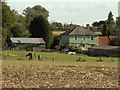
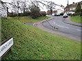
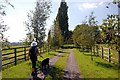
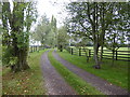
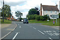
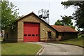
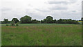
Three Fields Ward covers an extensive 80.8 square kilometres within the borough's administrative structure. Living in Three Fields Ward offers a defined sense of locality that balances wide-open space with established residential provision. The area functions as a significant district unitary ward, providing a broad canvas for communities to develop without the intense crowding often found in smaller districts. Residents navigate a landscape where household dynamics and accommodation styles reflect the region's broader character. Daily life here involves traversing a substantial geography, which influences how people access services and connect with neighbours. The ward's physical scale supports a variety of living arrangements while maintaining a distinct identity separate from adjacent zones. Prospective buyers recognise that Three Fields Ward represents a significant portion of the local administrative area, offering space for development and quiet. The 80.8 square kilometre footprint ensures that travel times between home locations and key amenities can vary significantly depending on specific postcode destinations. Understanding the ward's boundaries helps you assess the practicalities of moving to Three Fields Ward. The area's status as a major ward unit means it encompasses diverse settlements under one planning umbrella. You should consider how this spatial spread impacts your long-term commuting and lifestyle choices when evaluating homes in Three Fields Ward.
- Area Type
- District Borough Unitary Ward
- Area Size
- 80.8 km²
- Population
- Not available
- Population Density
- Not available
Demographics
The community profile within Three Fields Ward reveals a population with a median age of 70 years. This demographic statistic indicates a settlement characterised significantly by older residents compared to the national average. You will find that most Common Age Range data falls within brackets prominent in the later stages of adulthood. This age profile suggests a neighbourhood where retirement planning and mobility-friendly considerations hold considerable weight for every household. With 74% of residents owning their homes outright or with a mortgage, Three Fields Ward functions as a deeply entrenched owner-occupied area. Household composition data within the ward reflects the needs of a mature population. The high ownership rate means that most families have invested in properties they intend to keep for the long term. Accommodation types throughout Three Fields Ward likely cater to varying mobility requirements, though specific breakdowns remain part of the total ward picture. The predominance of older residents shapes local demand, influencing everything from shop hours to available estate agent inventory. When you consider buying homes in Three Fields Ward, you are entering a market where stability and permanence define the social fabric. You might find that neighbours have lived in their properties for decades, creating tight-knit communities based on shared history rather than transient urban trends.
Household Size
Accommodation Type
Tenure
Ethnic Group
Religion
Household Composition
Age
Household Deprivation
NS-SEC
Explore more demographic insights in this area
Go to Demographics tabPlanning
Planning Constraints
- Flood RiskPremium
- Ramsar Wetland SitesPremium
- Area of Outstanding Natural BeautyPremium
- Protected Nature ReservePremium
- Protected WoodlandPremium
- Crime RiskPremium