Area Overview for Thrandeston
Photos of Thrandeston
Area Information
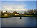
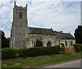
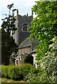
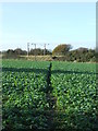
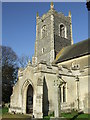
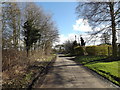
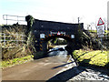
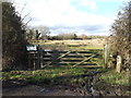
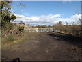
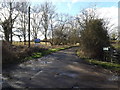
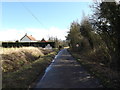
Thrandeston is a small civil parish located in Norfolk, England, covering an area of 5.6 km². Living in this locality means residing in a defined rural community where residents enjoy a settled pace of life. The parish sits within a specific administrative boundary that shapes the local governance and services available to inhabitants. Prospective buyers should understand the scale of the settlement before viewing properties, as the compact footprint of the area influences daily routines and access to wider facilities. The character of Thrandeston is defined by its status as a distinct parish, separate from larger neighbouring towns. Any discussion of homes in Thrandeston must acknowledge the specific geographical limits of this 5.6 square kilometre zone. Understanding the physical boundaries helps you gauge the distance to schools, shops, and transport links that lie just outside the parish limits. The area represents a self-contained environment where the built environment is managed at a parochial level rather than a municipal one. You will find that the rural nature of the parish offers privacy, though it may limit immediate access to urban amenities. The small size of the parish suggests a close-knit community structure where neighbours often know one another by name.
- Area Type
- Parish
- Area Size
- 5.6 km²
- Population
- Not available
- Population Density
- Not available
Demographics
The demographic profile of Thrandeston reveals a community that is heavily skewed towards older residents. The median age in the parish stands at 70 years, indicating that the population centre is far beyond the typical working age. Most Common Age Range data highlights that Age Total represents the dominant group, confirming that families with young children are a minority. This age distribution suggests a neighbourhood where retirees and older couples form the bulk of the local population. House ownership is extremely high at 81%, meaning that the vast majority of households in Thrandeston own their residences outright. This high rate of home ownership contrasts sharply with the higher rates found in major urban centres or high-density cities. With such a large proportion of owner-occupiers, the area rarely experiences the volatility associated with heavy rental markets. The absence of specific data on household composition nuances or predominant ethnic groups means that the visible population appears very homogenous in terms of age. You will likely find that neighbours share similar life stages and priorities regarding property maintenance and leisure.
Household Size
Accommodation Type
Tenure
Ethnic Group
Religion
Household Composition
Age
Household Deprivation
NS-SEC
Explore more demographic insights in this area
Go to Demographics tabPlanning
Planning Constraints
- Flood RiskPremium
- Ramsar Wetland SitesPremium
- Area of Outstanding Natural BeautyPremium
- Protected Nature ReservePremium
- Protected WoodlandPremium
- Crime RiskPremium