Area Overview for Thorpe St. Andrew South East Ward
Photos of Thorpe St. Andrew South East Ward

Area Information
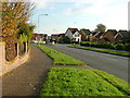
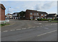
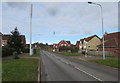
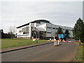
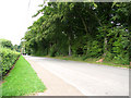
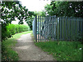
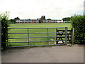
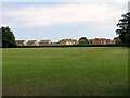
Thorpe St. Andrew South East Ward stands as a distinct electoral ward within the civil parish and town of Thorpe St Andrew in Broadland district. This district borough unitary ward covers a compact 4.2 km² on the north bank of the River Yare. The area lies approximately two miles east of Norwich city centre, positioning it effectively as a suburb despite maintaining its own administration. A 2021 census recorded a population of 14,526 residents for the parish, which spans 708 hectares. The community developed as a linear settlement along Yarmouth Road parallel to the river, with the church situated on its present site between 1461 and 1556. The historic environment includes Thorpe Hall, a Grade II* listed building created by Edward Harvey, alongside the ruins of the Church of St Andrew. Residents enjoy access to the Thorpe Conservation Area, which encompasses Yarmouth Road frontage and the wooded slopes of Racecourse Plantation. A local centre at Pound Lane provides essential amenities, including a Sainsbury's supermarket. You live here in a setting where the river valley meets modern extensions like South Avenue from the 1930s. The area offers specific views over the valley and easy access to the River Yare at Thorpe Green. Connecting features include low railway bridges leading towards the coast.
- Area Type
- District Borough Unitary Ward
- Area Size
- 4.2 km²
- Population
- Not available
- Population Density
- Not available
Demographics
Living in Thorpe St. Andrew South East Ward involves a community with a distinctly mature population profile. The median age for this area is 70 years, indicating a senior-heavy demographic. While specific breakdowns for most common age ranges are not detailed in available records, the high median age suggests a quiet environment often preferred by retirees. You should expect a neighbourhood where daily life revolves around the needs of an older population. Home ownership is the dominant housing arrangement, with 75% of households owning their property outright. This high rate of ownership points to a stable, long-term resident base rather than a transient rental market. Household composition data indicates a total recorded for the ward, though specific percentages for families versus singles are not individually broken out. The ward accommodates a total mix of accommodation types without specific distribution figures for detached versus semi-detached homes. You will find a population that has settled deeply in the Broadland district, taking advantage of the local parkland and conservation areas. The area represents a settled residential zone where families and individuals have built permanent roots over decades.
Household Size
Accommodation Type
Tenure
Ethnic Group
Religion
Household Composition
Age
Household Deprivation
NS-SEC
Explore more demographic insights in this area
Go to Demographics tabPlanning
Planning Constraints
- Flood RiskPremium
- Ramsar Wetland SitesPremium
- Area of Outstanding Natural BeautyPremium
- Protected Nature ReservePremium
- Protected WoodlandPremium
- Crime RiskPremium