Area Overview for Thorpe Hamlet Ward
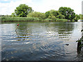
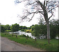
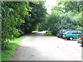
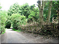
Photos of Thorpe Hamlet Ward
Area Information
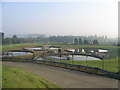
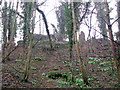
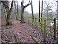
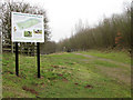
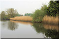
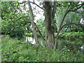
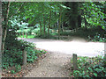
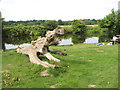
Living in Thorpe Hamlet Ward offers a quiet suburban experience on Norwich City Council's eastern boundary. This 4.0 km² district, home to 1,007 residents, balances historic charm with modern life. The ward was formally separated from Old Thorpe as an ecclesiastical parish in 1852 and includes landmarks like the Church of St Matthew in Telegraph Lane West. You'll find pockets of verdant spaces, such as Lion Wood and Telegraph Lane, which blend seamlessly with residential streets. Its proximity to Norwich city centre places schools and amenities within easy reach, while the ward's orientation along King Street and Bishopsgate creates a sense of community. Residents value its accessibility, with polling districts TH1–TH4 marking local governance areas. The presence of protected sites like Ramsar wetlands and woodlands adds ecological significance, though 38% of households own their properties, suggesting a mix of rentals and owner-occupiers. For those seeking calm yet connected living, Thorpe Hamlet Ward combines Norwich's urban conveniences with neighbourhood character, appealing particularly to families preferring smaller, manageable settings.
- Area Type
- District Borough Unitary Ward
- Area Size
- 4.0 km²
- Population
- 1007
- Population Density
- 254 people/km²
Demographics
Thorpe Hamlet Ward's community reflects a mature demographic profile. The median age stands at 70 years, indicating a predominantly older population. Household composition and ethnic diversity data are not specified in available records, but the area's age structure suggests families and retirees make up the bulk of residents. Only 38% of households own their homes, implying that rental arrangements dominate the local housing market. This contrasts with studies where ownership exceeds 60%, potentially influencing property investment dynamics. Access to schools near Thorpe Hamlet Ward remains a priority for buyers, given the ward's focus on mid and first schools. The low population density of 254 people per km² fosters a quiet environment, though limited data on household size or cultural diversity means assumptions about community vibrancy remain unsupported. For those considering living in Thorpe Hamlet Ward, the demographics highlight a quieter, established neighbourhood where adult residents and leisure-focused lifestyles prevail.
Household Size
Accommodation Type
Tenure
Ethnic Group
Religion
Household Composition
Age
Household Deprivation
NS-SEC
Explore more demographic insights in this area
Go to Demographics tabPlanning
Planning Constraints
- Flood RiskPremium
- Ramsar Wetland SitesPremium
- Area of Outstanding Natural BeautyPremium
- Protected Nature ReservePremium
- Protected WoodlandPremium
- Crime RiskPremium