Area Overview for Thornhaugh
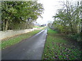
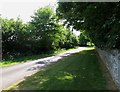
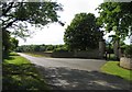
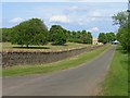
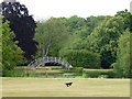
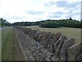
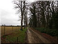
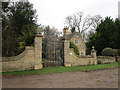
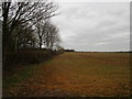
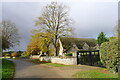
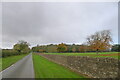
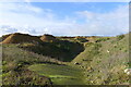
Photos of Thornhaugh
Area Information
Living in Thornhaugh means settling into a civil parish covering 11.0 km² of Northumberland. You find a distinctively quiet setting far from the noise of major urban centres. The community is deeply established, with a resident base that has grown accustomed to a slower pace of life. Daily life here revolves around the inherent character of a rural parish where neighbours likely have known each other for generations. This locality does not boast the amenities of a large town; instead, it offers a focused environment where distance to services must be factored into your routine. Prospective buyers often seek this specific slice of Northumberland for its isolation and stability. The area's size contributes to its charm, providing enough space for nature while maintaining a tight-knit social fabric. Families and retirees typically prefer this setting over denser neighbourhoods because it offers seclusion without total remoteness. You should consider whether you want a location where the primary draw is the quality of life rather than immediate access to amusement parks or high street shopping. Thornhaugh defines itself by its rural status and the specific quality of life it affords those willing to embrace a countryside existence. It is a place where the local rhythm dictates the schedule, and that rhythm is remarkably steady.
- Area Type
- Parish
- Area Size
- 11.0 km²
- Population
- Not available
- Population Density
- Not available
Demographics
The community in Thornhaugh is defined by a notably older population. The median age reaches seventy, indicating that the demographic skew is heavily towards retirees. Most residents fall into the older age brackets, creating a social environment where life stages with older generations dominate the local culture. You can expect a neighbourhood where community activities often cater to mature interests. This age profile suggests a stable population with strong roots in the parish, as younger families frequently move to larger towns with better school provision. Home ownership stands at sixty-six per cent within the parish. This high figure demonstrates that the majority of houses are owner-occupied rather than rented. You are more likely to meet long-term residents who have built their equity locally than tenants moving between properties every few years. The accommodation types reflect this stability, with dwellings designed for permanence and settled living. While specific data on household composition breaks down individual types, the overall picture points to traditional family homes and retirement properties. The demographic structure means the area feels settled and unchanging, which appeals to those seeking a predictable environment. No significant youth migration patterns disrupt the continuity of life here, making it a foreground choice for those prioritising a mature, steadfast community atmosphere.
Household Size
Accommodation Type
Tenure
Ethnic Group
Religion
Household Composition
Age
Household Deprivation
NS-SEC
Explore more demographic insights in this area
Go to Demographics tabPlanning
Planning Constraints
- Flood RiskPremium
- Ramsar Wetland SitesPremium
- Area of Outstanding Natural BeautyPremium
- Protected Nature ReservePremium
- Protected WoodlandPremium
- Crime RiskPremium