Area Overview for Thorington
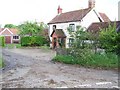
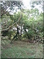
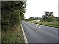
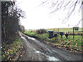
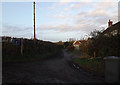
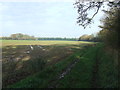
Photos of Thorington
Area Information
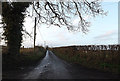
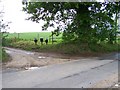
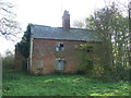
Living in Thorington means residing within a civil parish that spans 5.8 square kilometres of settled land in England. You will find a community defined by its established character and proximity to natural features, rather than rapid expansion or new construction projects. The area size suggests a compact layout where neighbours are likely within easy walking distance, fostering a tight-knit local environment. Daily life here revolves around the quiet rhythms of a traditional settlement where you can access local amenities without travelling far. The parish offers a distinct sense of place for those seeking a slower pace. You are surrounded by green spaces protected by planning designations, which shapes the landscape and restricts certain types of development. This ensures that the visual character of Thorington remains consistent, preserving views and open areas for current and future residents. If you are looking for a home in Thorington, you are entering a setting where the built environment coexists with protected woodland and natural grounds. Prospective buyers should appreciate that the area manages to maintain safety and stability while adhering to environmental constraints. The balance between residential use and nature preservation defines what it is like to build a life here. You will not find high-density blocks or large industrial sites dominating the skyline. Instead, the neighbourhood feels intimate, where the 5.8 km² footprint contains the essential social fabric of the village. This makes Thorington a practical choice for those who value a defined boundary between their home and the wider countryside.
- Area Type
- Parish
- Area Size
- 5.8 km²
- Population
- Not available
- Population Density
- Not available
Demographics
The community within Thorington reflects an older demographic profile, with a median age of 70 years. This figure indicates that the resident population consists largely of seniors who have moved to the area for retirement or chose to remain as they aged. You are likely to encounter a neighbourhood where many residents have deep roots or have settled permanently in recent decades. The age range data confirms that "Age: Total" is the most common reporting category, reinforcing the overall maturity of the population. Home ownership stands at 76%, which is significantly high compared to national averages. This statistic reveals that the vast majority of households in Thorington own their residences outright or with substantial equity. You will find few private landowners or tenants renting from private landlords. Instead, the housing stock supports families and individuals who have built long-term ties to the local address. This high ownership rate often correlates with a stable community where property values reflect the attachment residents have to their homes. The household composition data appears under the category "total," suggesting a standard aggregation of dwelling types rather than a specific breakdown of single-person or multi-generational homes. There is a clear thread of permanence running through the accommodation patterns you observe on the streets. You will not experience the transient nature of student housing or young professional rental schemes here. The 76% ownership figure acts as a strong indicator of the area's suitability for retirement living.
Household Size
Accommodation Type
Tenure
Ethnic Group
Religion
Household Composition
Age
Household Deprivation
NS-SEC
Explore more demographic insights in this area
Go to Demographics tabPlanning
Planning Constraints
- Flood RiskPremium
- Ramsar Wetland SitesPremium
- Area of Outstanding Natural BeautyPremium
- Protected Nature ReservePremium
- Protected WoodlandPremium
- Crime RiskPremium