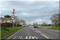
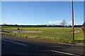
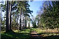
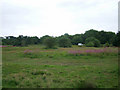
Area Overview for Thetford Burrell Ward
Photos of Thetford Burrell Ward
Area Information
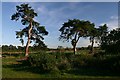
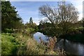
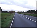
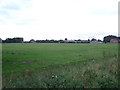
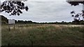
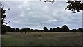
Living in Thetford Burrell Ward means embracing a compact, tranquil community within a single district borough unitary ward covering just 4.6 square kilometres. This area of England caters to those seeking a quieter lifestyle, with a median resident age of 70 reflecting its older demographic. Half of households here own their homes, indicating stability for long-term dwellers, while the remaining opt for rental arrangements. The neighbourhood balance reflects practical considerations rather than dense urban living, making it suitable for individuals and retirees valuing space over proximity to city centres. Daily life in Thetford Burrell Ward revolves around local amenities supported by reliable digital connectivity, scoring 74 out of 100 on fixed broadband quality. This ensures robust internet access for remote work or leisure activities without significant disruption. While crime risk registers as medium with a safety score of 58/100, standard precautions suffice, and flood risks remain low at a passable 6.13 rating. Residents appreciate the absence of major planning constraints like protected woodlands or Ramsar sites, though the presence of safeguarded nature reserves adds environmental value. Homes in Thetford Burrell Ward appeal to those prioritising calm surroundings over bustling high streets, with community cohesion forged through shared appreciation of the local landscape.
- Area Type
- District Borough Unitary Ward
- Area Size
- 4.6 km²
- Population
- Not available
- Population Density
- Not available
Demographics
The inhabitants of Thetford Burrell Ward form a community defined by its mature age profile, with a median age of 70 spanning the wider household composition. Fourty-nine percent of residents own their homes, suggesting a stable population with deep local ties. The remaining 51% reside in rental properties, creating a balanced yet predominantly settled environment. While specific breakdowns of household types or accommodation variety remain unbroken in public records, the area's demographic structure points to a neighbourhood built around long-term habitation rather than transient living. Ethnic diversity, religious affiliation, and deprivation metrics lack isolated data, meaning any assumptions about these areas would be speculative. Instead, the focus remains on observable trends: an older population concentrated within a single ward and a split between ownership and tenancy. This profile suits individuals seeking a quiet, established community but requires buyers to consider potential mobility challenges linked to age. Thetford Burrell Ward does not cater to young families or students due to the absence of youth-focused data, though the 49% ownership rate hints at moderate investment in local housing. For families considering Thetford Burrell Ward, understanding the age skew is crucial, as services like schools near Thetford Burrell Ward may reflect community needs aligned with an older demographic.
Household Size
Accommodation Type
Tenure
Ethnic Group
Religion
Household Composition
Age
Household Deprivation
NS-SEC
Explore more demographic insights in this area
Go to Demographics tabPlanning
Planning Constraints
- Flood RiskPremium
- Ramsar Wetland SitesPremium
- Area of Outstanding Natural BeautyPremium
- Protected Nature ReservePremium
- Protected WoodlandPremium