Area Overview for Thetford
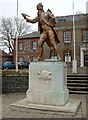
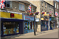
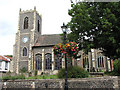
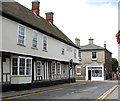
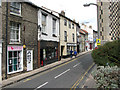
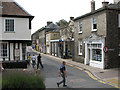
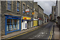
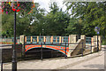
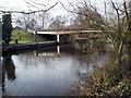
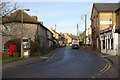
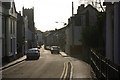
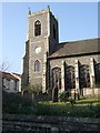
Photos of Thetford
Area Information
Thetford is a built-up area situated in the heart of England, covering a total land mass of 7.3 km². The location supports a population of 3,171 residents, resulting in a density of 434 people per square kilometre. This figure indicates a compact, established community rather than a sprawling municipality. The town serves as a significant node within the local network, offering a balance between rural charm and accessible services. Living in Thetford provides residents with a defined sense of place where every day necessitates a connection to the central hub. Homes in Thetford cater to a specific demographic, reflecting the town's historical development and modern residential needs. Prospective buyers must understand that this is a town of substantial character, defined by its size and resident population. The area functions as a complete living environment, distancing itself from the anonymity of larger cities while maintaining vital links to the wider region. Your daily life here will be shaped by these concrete boundaries and communal expectations. Thetford remains a focal point for those seeking a settled lifestyle within a clearly defined geographical footprint.
- Area Type
- Built Up Area 250
- Area Size
- 7.3 km²
- Population
- 3171
- Population Density
- 434 people/km²
Daily life in Thetford revolves around a cluster of practical amenities located within practical reach of homes. Retail options are well established, with five key hypermarkets and supermarkets servicing the town. Iceland Thetford, Tesco Thetford, and Aldi East provide comprehensive grocery shopping directly to your doorstep. The presence of three rail stations, including Thetford Railway Station and Brandon Railway Station, ensures excellent connectivity for commuters. Travelers can also access RAF Honington, the sole airport listed within reasonable proximity. These amenities create a self-sufficient environment where most daily needs are met without driving long distances. The variety of retail outlets ensures that you do not need to travel outside the built-up area for groceries. Convenience stores and major chains coexist to serve different shopping habits. This concentration of facilities defines the lifestyle, offering a blend of independence and ease for residents looking to settle.
Amenities
Schools
Families requiring education services near Thetford have access to several specific institutions within the locality. The area includes Queensway Infant School and Nursery and Thetford Queensway Community Junior School, which operate as primary providers for younger children. Additionally, Raleigh Infant School and Nursery is listed as a primary option within the town limits. Redcastle Family School also falls under the primary category and holds a good Ofsted rating, offering a verified standard of education for parents to consider. The Senior Tutorial Centre is another facility present, though its classification under the 'other' category suggests it may serve specialized or adult learners rather than standard school-age children. This mix provides a range of primary education choices, from the well-regarded Redcastle to the standard Queensway establishments. The absence of secondary schools in the immediate list implies that older students likely commute to neighbouring towns for high school education. You must plan journeys to outside the immediate Thetford boundary for secondary schooling.
| Rank | School | Type | Entry gender | Ages |
|---|
Explore more schools in this area
Go to Schools tabDemographics
The community profile of Thetford is heavily weighted towards older residents. The median age stands at 70, which establishes the town as an area predominantly inhabited by seniors. This demographic skew influences the energy and pace of local life significantly. Home ownership rates reach 55 per cent, indicating that the majority of households own their properties outright or with a mortgage. This high level of ownership typically suggests long-term residents with established roots in the borough. The data does not provide a breakdown of specific ethnic groups, religions, or detailed household compositions beyond these primary statistics. Every claim regarding the population structure here refers to these exact figures. The absence of younger families is evident in the age data, creating a neighbourhood atmosphere focused on retirement living rather than young professionals. Deprivation metrics are not quantified in the current dataset, so the quality of life is best understood through the lens of ownership stability and age. A 55 per cent ownership rate in a town with a median age of 70 paints a clear picture of a traditional, settled Silver Coast style community rather than a commuter belt suburb.
Household Size
Accommodation Type
Tenure
Ethnic Group
Religion
Household Composition
Age
Household Deprivation
NS-SEC
Explore more demographic insights in this area
Go to Demographics tabPlanning
Planning Constraints
- Crime RiskPremium