Area Overview for The Sampfords Ward
Photos of The Sampfords Ward
Area Information
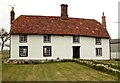
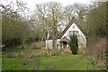
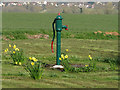
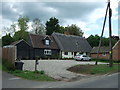
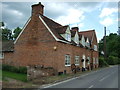
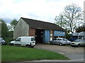
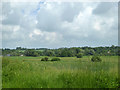
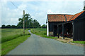
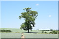
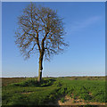
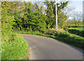
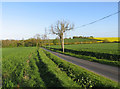
The Sampfords Ward is a rural district council ward within Uttlesford District Council in Essex. It covers an area of 59.0 km² and includes villages such as Great Sampford and Little Sampford. Great Sampford sits on the eastern edge of Uttlesford at the junction of the B1053 and B1051 roads. The town of Thaxted lies about three miles to the southwest, while Saffron Walden is approximately eight miles to the southeast. You will find the River Pant running through this landscape. Living in The Sampfords Ward means residing in a community that operates on a country-side rhythm. The ward operates under the local governance of the Uttlesford district administration. Your daily commute likely involves travel along established rural routes rather than major motorways. Great Bardfield offers public rights of way for footpaths and bridleways nearby. This location provides access to local amenities while maintaining a distinct separation from larger urban centres. The geography places you just north of the main urban cluster in Uttlesford. Saffron Walden remains the primary service town within a reasonable driving distance. The Sampfords Ward represents a choice for those seeking a quieter existence with defined rural boundaries.
- Area Type
- District Borough Unitary Ward
- Area Size
- 59.0 km²
- Population
- Not available
- Population Density
- Not available
Demographics
The community demographic profile reveals a settled population with a median age of 70 years. This figure indicates a predominantly older resident base within The Sampfords Ward. The data shows that home ownership stands at 79 per cent across the ward. Seven in ten households own their property outright or with a mortgage. This high ownership rate contrasts with typical buy-to-let concentrations found in commuter belts. You are likely to meet long-term residents who have called this place home for decades. There is little evidence of transient populations or high-density rental zones. The household composition reflects a stable demographic structure common in older British villages. Accommodation types align with traditional rural dwelling patterns. The age structure suggests specific community needs regarding healthcare and leisure. Shopping habits here will closely mirror local requirements rather than external trends. The median age of 70 years shapes the social fabric of Great Sampford and Little Sampford. Families with young children are less common compared to retirees or older adults. Your neighbours are likely to be peers with similar life experiences and economic backgrounds. The 79 per cent ownership figure confirms a neighbourhood defined by stability rather than rapid turnover.
Household Size
Accommodation Type
Tenure
Ethnic Group
Religion
Household Composition
Age
Household Deprivation
NS-SEC
Explore more demographic insights in this area
Go to Demographics tabPlanning
Planning Constraints
- Flood RiskPremium
- Ramsar Wetland SitesPremium
- Area of Outstanding Natural BeautyPremium
- Protected Nature ReservePremium
- Protected WoodlandPremium