Area Overview for The Salings
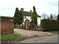
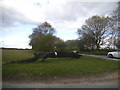
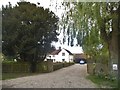
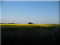
Photos of The Salings
Area Information
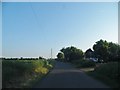
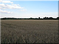
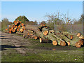
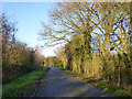
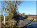
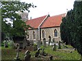
Living in The Salings offers a quiet life within a civil parish in the Braintree District of Essex. This parish was formed in 2019 when Great Saling and Bardfield Saling merged, creating a community that spans 11.3 km². You will find yourself nestled roughly six kilometres north-west of Braintree town, an arrangement that defines the locality's rural character. The area sits at coordinates 51.904°N, 0.467°E, placing it in the Eastern English Region. Daily life here is shaped by a low population density, with just 475 inhabitants recorded in the 2011 census. This small figure explains the sparse nature of the settlement compared to larger towns nearby. History permeates the local landscape, most notably through the presence of St James Church, a Grade II* listed building dedicated to St James. The church remains in the Diocese of Chelmsford and stands as a testament to the parish's ancient past. Great Saling once featured a village green with a massive elm tree, reputed to be the largest in England. Although this tree succumbed to Dutch Elm Disease in the 1970s, it remains a significant part of the area's heritage. During the Second World War, the nearby RAF Andrews Field operated as the first aerodrome built by the United States Army Air Forces on British soil. Residents value these historical anchors while enjoying the benefits of modern connectivity and relative proximity to educational and shopping hubs in Braintree.
- Area Type
- Parish
- Area Size
- 11.3 km²
- Population
- Not available
- Population Density
- Not available
Demographics
The community in The Salings is defined by a very mature population structure. The median age for residents stands at 70 years, indicating that this is a retirement-focused area where life generally slows down. There is no specific data provided for the most common age range other than the aggregate total, but the high median age confirms that young families are not the primary demographic. Consequently, you will engage with a society where neighbours are typically peers or seniors, fostering a calm and settled atmosphere. Local activity centres around the needs and interests of this older generation rather than the energy of a mixed-age village. Home ownership is the standard living arrangement within the parish, with a striking 76% of residents owning their homes outright or with a mortgage. This high rate suggests financial stability within the community and a long-term commitment to the locality. The remaining 24% of households exist within the rental sector, though specific details on accommodation types such as flats or detached houses are not detailed in the current records. There is no available information regarding the predominant ethnic group or religious composition of the parish. Regardless of these missing specifics, the demographic snapshot points to a homogenous, older, and owner-occupied community where the pace of life is dictated by the needs of those over seventy.
Household Size
Accommodation Type
Tenure
Ethnic Group
Religion
Household Composition
Age
Household Deprivation
NS-SEC
Explore more demographic insights in this area
Go to Demographics tabPlanning
Planning Constraints
- Flood RiskPremium
- Ramsar Wetland SitesPremium
- Area of Outstanding Natural BeautyPremium
- Protected Nature ReservePremium
- Protected WoodlandPremium
- Crime RiskPremium