Area Overview for The Bentleys & Frating Ward
Photos of The Bentleys & Frating Ward

Area Information
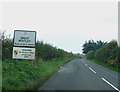
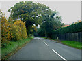
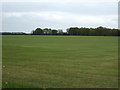
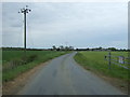
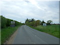
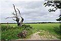
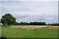
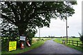
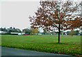
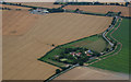
Living in The Bentleys & Frating Ward places you at the heart of a distinct district unitary ward covering 26.4 km². This area defines itself through a quiet, established character rather than rapid urban expansion. You will find a community where daily life moves at a measured pace, shaped by significant environmental factors like nearby Ramsar wetland sites and protected woodland. While these natural features impose planning constraints that limit development, they also provide a defined backdrop for your home life. The ward functions as a contained neighbourhood with specific boundaries, offering a sense of stability that appeals to those seeking permanence over fleeting trends. You are entering an environment where the landscape itself plays an active role in shaping local experience. The combination of open spaces and limited industrial intrusion creates a setting where the focus remains on residence and nature. This ward stands apart from more commercial zones due to its specific classification and geographical scope. Your mornings and evenings will unfold within this 26.4 square kilometre footprint, offering a consistent and unchanging rhythm to your routine.
- Area Type
- District Borough Unitary Ward
- Area Size
- 26.4 km²
- Population
- Not available
- Population Density
- Not available
Demographics
The community in The Bentleys & Frating Ward reflects a distinctly mature population, with a median age of 70 years. This high average suggests an area populated primarily by older residents who have built long-term roots in the locality. You are walking into a neighbourhood where the majority of your neighbours will be seniors, creating a stable social environment with established habits and routines. Data indicates that 84% of households here own their homes, confirming a culture of staying put rather than renting temporarily. Such highOwnership levels typically signal residents who have invested deeply in their local environment and intend to remain for the duration of their lives. The demographic profile does not fluctuate with typical migration patterns seen in younger urban centres. Instead, it represents a settled cohort with little turnover. As you explore schools near The Bentleys & Frating Ward, remember that the primary student body will likely consist of the offspring of these long-standing families or residents from wider regions moving into the broader borough. The area prioritises long-term residence over transient living, resulting in a predictable community dynamic where neighbours know each other well and commitments span generations.
Household Size
Accommodation Type
Tenure
Ethnic Group
Religion
Household Composition
Age
Household Deprivation
NS-SEC
Explore more demographic insights in this area
Go to Demographics tabPlanning
Planning Constraints
- Flood RiskPremium
- Ramsar Wetland SitesPremium
- Area of Outstanding Natural BeautyPremium
- Protected Nature ReservePremium
- Protected WoodlandPremium
- Crime RiskPremium