Area Overview for Thaxted & the Eastons Ward
Photos of Thaxted & the Eastons Ward

Area Information
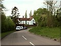
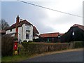
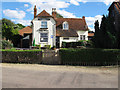
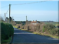
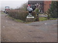
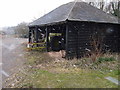
Living in Thaxted & the Eastons Ward means residing in a rural district council ward within Uttlesford District, located in north-west Essex. This area encompasses the civil parishes of Thaxted, Great Easton, and Little Easton, covering a total land size of 55.6 square kilometres. You will find the ward centred around coordinates 51.92874461300124, 0.3457663041065144, offering a countryside setting administered by Uttlesford District Council based in Saffron Walden. Daily life here revolves around a largely rural environment where the pace is dictated by local village centres rather than major urban hubs. The area benefits from access to B-roads like the B184, which runs via Thaxted and Great Dunmow from Stump Cross to the Rodings. You also have proximity to the M11 motorway, which provides junctions at Stansted Airport and Stump Cross, alongside the A120 that travels east-west through the district via Great Dunmow. Homes in Thaxted & the Eastons Ward typically serve residents who value a quiet setting with direct access to listed roads connecting to wider transport networks. Your daily commute relies on these arterial routes, making the ward a practical choice for those who can tolerate limited local public transit in exchange for road access.
- Area Type
- District Borough Unitary Ward
- Area Size
- 55.6 km²
- Population
- Not available
- Population Density
- Not available
Demographics
The community in Thaxted & the Eastons Ward is defined by an older population demographic. The median age of residents is 70 years old, and the most common age range falls under the total age bracket category. Home ownership is the dominant household characteristic, with 74% of residents owning their property. The remaining households likely consist of rented accommodation or those without title deeds, though specific breakdowns for these groups are not detailed in available records. Households in this ward do not exhibit a predominant ethnic group or specific religious affiliation based on the total data provided. Deprivation levels are not quantified in the current dataset, so quality of life considerations must rely on known safety and infrastructure metrics instead. The lack of young families or working-age professionals in significant numbers suggests a retirement hamlet atmosphere rather than a multi-generational hub. When you shop locally or use community facilities, you will likely encounter an electorate that has moved to the area later in life rather than raised their families there. This demographic skew shapes local services, likely prioritising healthcare access and leisure over schooling resources.
Household Size
Accommodation Type
Tenure
Ethnic Group
Religion
Household Composition
Age
Household Deprivation
NS-SEC
Explore more demographic insights in this area
Go to Demographics tabPlanning
Planning Constraints
- Flood RiskPremium
- Ramsar Wetland SitesPremium
- Area of Outstanding Natural BeautyPremium
- Protected Nature ReservePremium
- Protected WoodlandPremium
- Crime RiskPremium