Area Overview for Takeley
Photos of Takeley

Area Information
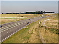
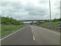
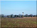
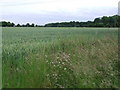
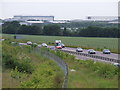
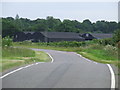
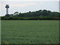
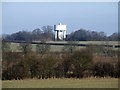
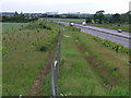
Takeley is a civil parish in the Uttlesford district of Essex, covering 13.4 km² of land. The area sits approximately 4 miles east of Bishop's Stortford and lies directly on the line of the Roman road Stane Street connecting Braughing to Colchester. Living in Takeley means residing in a dispersed rural settlement that incorporates multiple distinct neighbourhoods. You will find homes organised around specific locations such as Brewer's End, The Street, Smith's Green, Bamber's Green, Molehill Green, and Mill End. The parish is large in scale, originally spanning 3,000 acres with boundaries recorded in 1086, though it has since lost nearly a third of its land due to the development of London Stansted Airport. Despite this modern encroachment, the village has retained much of its rural character defined by these historic Ends and Greens. You can walk past a 12th-century Grade I listed church and visit conservation areas that reflect the settlement's history. While part of the parish sits within the London Stansted Airport boundary, including the main passenger facilities and railway station, the residential villages maintain a sense of distance from the airport's primary operations. The community benefits from a mixture of historic sites, such as a first-century farmstead near Pincey Brook, and post-war developments like the housing at Wayletts Hill established from 1948.
- Area Type
- District Borough Unitary Ward
- Area Size
- 13.4 km²
- Population
- Not available
- Population Density
- Not available
Demographics
The community in Takeley presents a distinct profile compared to many modern towns. A median age of 70 indicates that the population skews significantly towards older residents. This demographic makeup suggests a village that may host a large retiree population alongside the remaining working-age community. The area shows a strong preference for permanent residence, with 66% of homes being owner-occupied. This high level of ownership typically stabilises the local population and reduces tenant turnover. Household composition in Takeley aligns with the national average when looking at total figures, though the age profile suggests different internal family structures. You should note that the dominant age bracket listed in the provided statistics is "Age: Total", which serves as a summary rather than a specific range breakdown. The parish does not highlight specific predominant ethnic groups or religious affiliations in the current data, reflecting the typical demographic consistency of rural villages in Uttlesford. For those interested in schools near Takeley, the high ownership rates imply many families settle permanently, yet the age data suggests a quieter period for day-to-day activity from this demographic group. The community relies heavily on local institutions, with the parish council established in 1895 guiding development far removed from the rapid changes seen in larger urban centres.
Household Size
Accommodation Type
Tenure
Ethnic Group
Religion
Household Composition
Age
Household Deprivation
NS-SEC
Explore more demographic insights in this area
Go to Demographics tabPlanning
Planning Constraints
- Flood RiskLocked
- Ramsar Wetland SitesLocked
- Area of Outstanding Natural BeautyLocked
- Protected Nature ReserveLocked
- Protected WoodlandLocked
- Crime RiskLocked