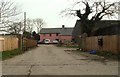
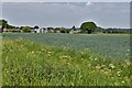
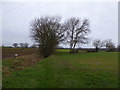
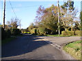
Area Overview for Syleham
Photos of Syleham

Area Information
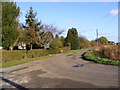
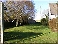
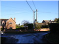
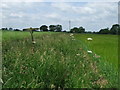
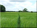
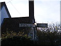
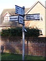
Living in Syleham offers a distinctly rural experience within a civil parish covering 6.5 km² of land. This small settlement provides a quiet setting where daily life moves at a considered pace, far removed from the density of urban centres. The area is defined by its limited footprint, which fosters a close-knit environment rather than the sprawling nature of larger towns. You will find that the community is characterised by long-term residency, creating a stable atmosphere for those seeking simplicity over urban convenience. While the specific boundary lines of the parish remain fixed, the sense of place comes from the intimate scale of the locality itself. Homes in Syleham sit within a compact landscape, meaning neighbours are invariably known and public spaces are shared resources rather than monumental districts. This configuration suits individuals who value predictability and who desire a life dictated by natural rhythms rather than commuter schedules. The area maintains its identity as a self-contained parish, ensuring that essential interactions occur within a familiar and manageable environment. For anyone prioritising a retreat from city life while retaining access to necessary services, the small size of this community proves significant.
- Area Type
- Parish
- Area Size
- 6.5 km²
- Population
- Not available
- Population Density
- Not available
Demographics
The community in Syleham is defined by a notably mature population profile. The median age stands at 70 years, indicating that the majority of residents are retirees or senior citizens. This demographic reality suggests an area where life often revolves around leisure, established routines, and family connections rather than early career stages. With 79% of homes owned outright, the local people have likely put down deep roots over many decades, reinforcing the stability of this age group. The high rate of home ownership correlates strongly with the older median age, as individuals typically accumulate property equity before reaching retirement. Little data exists on household composition breakdowns beyond the aggregate figures provided, but the overall picture points to a population seeking permanence. There is no indication of a transient population common in tourist hubs or student locations. The demographic structure implies a community where neighbours know each other across generations, fostering a supportive local network. This settlement does not cater to young families seeking entry-level housing or young professionals looking for flats; instead, it accommodates those with established means and long-term intentions.
Household Size
Accommodation Type
Tenure
Ethnic Group
Religion
Household Composition
Age
Household Deprivation
NS-SEC
Explore more demographic insights in this area
Go to Demographics tabPlanning
Planning Constraints
- Flood RiskPremium
- Ramsar Wetland SitesPremium
- Area of Outstanding Natural BeautyPremium
- Protected Nature ReservePremium
- Protected WoodlandPremium
- Crime RiskPremium