Area Overview for Swanton Novers
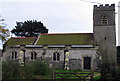
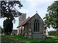
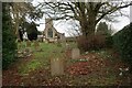
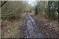
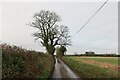
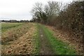
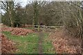
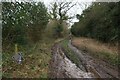
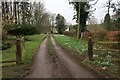
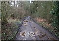
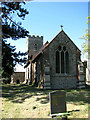
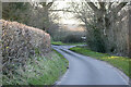
Photos of Swanton Novers
Area Information
Swanton Novers stands as a distinct civil parish, offering a quiet slice of rural life within England. The area covers a modest footprint of 5.4 square kilometres, presenting a compact community where local residents know one another. You are stepping into a village setting where daily life revolves around established routines and proximity to immediate neighbours. The character of Swanton Novers is defined by its size; it is not a sprawling town but a focused parish where the distance to amenities is usually measured in a short drive rather than a long commute. Living here means enjoying a peaceful environment where the pace of life slows down considerably compared to urban centres. The limited geographical spread ensures that seasonal changes and local weather affect the entire community uniformly. This small scale fosters a strong sense of locality, though it also means that major developments or large-scale infrastructure projects outside the parish borders could have a noticeable impact on your routine. You will find that Swanton Novers offers a specific type of retirement-focused lifestyle, given the significant proportion of older residents. The area functions as a self-contained unit where the local history and social fabric remain tightly woven around its few roads and houses.
- Area Type
- Parish
- Area Size
- 5.4 km²
- Population
- Not available
- Population Density
- Not available
Demographics
The demographic landscape of Swanton Novers is characterised by a distinctly older population. The median age within the parish stands at 70 years old, painting a clear picture of a community dominated by retirees and older couples. This age profile suggests that the local amenities and services cater primarily to mature needs, from healthcare access to leisure activities suitable for the elderly. With a home ownership rate of 73%, the majority of households in Swanton Novers own the properties they occupy. This high level of ownership indicates stability and a long-term investment in the local area, rather than a transient rental market. The data shows that the household composition reflects this demographic shift, with fewer young families or single professionals moving into the parish. You will find that the community is less likely to experience the churn associated with student housing or young entrepreneurship. This static population creates a reliable environment where neighbours settle down for decades. The area is not statistically defined by ethnic diversity or religious majorities in the provided figures, but the aging trend is the defining social structure. Understanding that 70% of your neighbours are likely to be over the age of 50 is crucial if you are considering bringing your own family to this specific spot. The community feel here is anchored by people who have built their lives in Swanton Novers for a significant portion of their adulthood.
Household Size
Accommodation Type
Tenure
Ethnic Group
Religion
Household Composition
Age
Household Deprivation
NS-SEC
Explore more demographic insights in this area
Go to Demographics tabPlanning
Planning Constraints
- Flood RiskPremium
- Ramsar Wetland SitesPremium
- Area of Outstanding Natural BeautyPremium
- Protected Nature ReservePremium
- Protected WoodlandPremium
- Crime RiskPremium