Area Overview for Sumners & Kingsmoor Ward
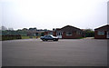
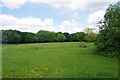
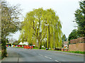
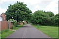
Photos of Sumners & Kingsmoor Ward
Area Information
Sumners and Kingsmoor Ward is a defined electoral district within the Harlow District Council area in Essex. Established during a local government boundary review effective from May 2024, this ward replaced previous administrative divisions to align with current parliamentary orders. The territory spans 2.8 square kilometres and accommodates a population of 1,766 residents. This creates a local density of 641 people per square kilometre. Living in Sumners and Kingsmoor Ward means residing within a specific geographic boundary that has been formally recognised since the 2024 elections. The area includes the postcode CM18 7LS and is situated in the East of England region. You are part of a community defined by these precise geographical limits and recent administrative changes. The ward replaces former boundary configurations approved by Parliament. This context matters for understanding local government reporting and council representation. The area operates under the direct oversight of Harlow District Council. Residents here navigate a specific post-code and coordinate system located at 51.753567 degrees north and 0.090251 degrees east. Daily life is shaped by these fixed boundaries and the population size of nearly 1,800 inhabitants. Knowledge of the ward's exact scope helps you understand local service delivery and planning constraints. The establishment of this ward structure ensures that administrative functions cover this specific patch of land across Harlow.
- Area Type
- District Borough Unitary Ward
- Area Size
- 2.8 km²
- Population
- 1766
- Population Density
- 641 people/km²
Demographics
The community profile of Sumners and Kingsmoor Ward shows a population where the median age is 70 years. This indicates a resident base that is significantly older than the national average. Total household composition and accommodation type data are available but remain unbroken down into specific sub-categories in the current records. Home ownership stands at 56% of total households. This means slightly more than half of all residents own their property outright or with a mortgage. The remaining 44% of households reside in rented accommodation. Household composition data is recorded as a total figure but lacks further segmentation into single-person, couple, or family units. There is no specific data provided for predominant ethnic groups within this ward profile. Religion statistics are also recorded as a total without further breakdown. You should approach the demographic picture with the clarity that age is the primary distinguishing feature. The high median age suggests a retirement-dominant population or an area with long-term fixed residents. Home ownership rates are moderate compared to many affluent suburban neighbours. The lack of granular data on ethnicity or specific household sizes limits detailed profiling of daily social interactions. Safety scores and crime risk metrics provide more utility than current demographic subtotals. You get a clear numerical picture of age and property tenure but not of cultural or family structure diversity. The population of 1,766 people lives within these statistical parameters.
Household Size
Accommodation Type
Tenure
Ethnic Group
Religion
Household Composition
Age
Household Deprivation
NS-SEC
Explore more demographic insights in this area
Go to Demographics tabPlanning
Planning Constraints
- Flood RiskPremium
- Ramsar Wetland SitesPremium
- Area of Outstanding Natural BeautyPremium
- Protected Nature ReservePremium
- Protected WoodlandPremium
- Crime RiskPremium