Area Overview for Oulton Broad
Photos of Oulton Broad


Area Information
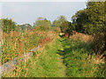
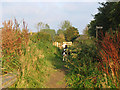
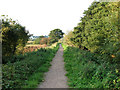
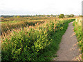
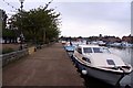
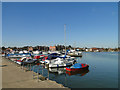
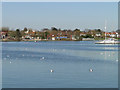
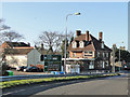
Oulton Broad functions as a distinct civil parish within East Suffolk, situated at the easterly point of the Suffolk Broads. This location places the area approximately two and a half miles west of Lowestoft, near Lake Lothing and the River Waveney. The parish covers an area of five square kilometres, forming a ward of the Lowestoft borough. Its identity is deeply tied to its classification as a broad, which is a navigable lake created during medieval peat digging. History dates back to the 1870s when records described it as a hamlet and parish in the Mutford district. Formal creation of the civil parish occurred in 1904 under the Local Government Act 1898. The original designation was Mutford Bridge Village before incorporating the names Carlton Colville and Oulton. Your daily life here revolves around waterways and heritage. The community features Oulton High House, a building constructed in 1550. Commerce once flourished due to the arrival of the Great Eastern Railway between 1844 and 1847. This development spurred trade, including the establishment of maltings and the growth of boat-building firms like Brooke Marine after the 1880s. Today, the museum in Nicholas Everitt Park highlights this maritime past with exhibits on local history and porcelain. You will find that life centres on the broad itself, where boating and navigation remain significant activities. The area touches the Norfolk boundary, offering a unique position on the Suffolk coast without being part of an Area of Outstanding Natural Beauty. This setting, combined with its history of navigation and trade, defines the character of living in this parish.
- Area Type
- Parish
- Area Size
- 5.0 km²
- Population
- Not available
- Population Density
- Not available
Demographics
The community profile of Oulton Broad reveals a settled population with a median age of seventy years. This figure indicates a demographic heavily weighted towards older adults. The most common age range spans the total adult population, reflecting the lack of a significant younger cohort. You will encounter a neighbourhood where the average resident has likely lived here for many decades. Home ownership is the dominant housing tenure, with seventy-seven per cent of properties held by owners. This high statistic suggests a stable community with long-term residents rather than transient populations or student enclaves. Accommodation types align with this ownership trend, indicating a stock where owners fully occupy their dwellings. The household composition reflects a mature population structure typical of East Suffolk parishes. Diversity data is not detailed in the available statistics for this specific parish, but the overall picture points towards a homogeneous, established community. There are no indicators suggesting a youthful influx or a shrinking population size, as the median age remains steady. The seventy per cent home ownership rate is a strong indicator of financial stability among residents. You can expect a quiet atmosphere where life moves at a pace suited to retirement and established households. This demographic profile supports local amenities that cater to older needs, such as accessible parks and museum facilities managed by local trusts.
Household Size
Accommodation Type
Tenure
Ethnic Group
Religion
Household Composition
Age
Household Deprivation
NS-SEC
Explore more demographic insights in this area
Go to Demographics tabPlanning
Planning Constraints
- Flood RiskPremium
- Ramsar Wetland SitesPremium
- Area of Outstanding Natural BeautyPremium
- Protected Nature ReservePremium
- Protected WoodlandPremium