Area Overview for Oulton
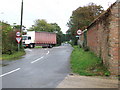
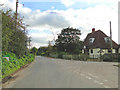
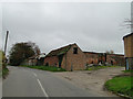
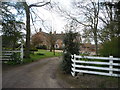
Photos of Oulton

Area Information
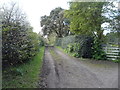
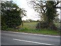
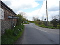
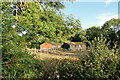
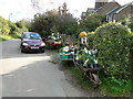
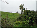
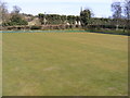
Living in Oulton offers a quiet retreat within a civil parish that covers just 4.6 square kilometres. This small footprint defines the community experience, creating an intimate setting where neighbours often know each other by name. The area sits in England as a distinct parish, removing the noise and congestion often found in larger towns while retaining a connection to the surrounding countryside. Your daily routine here revolves around local amenities within a compact boundary, meaning most errands are completed without long commutes for those who lack a car. The scale of the parish suggests a pace of life that many find relaxing, away from the frantic energy of major urban centres. You will not find sprawling suburbs or high-rise blocks; instead, the landscape is shaped by the natural topography of this specific stretch of land. For you, this means a lifestyle centred on locality and familiarity. When you consider homes in Oulton, you are choosing a place defined by its manageable size and its status as a traditional parish. The environment is close-knit and straightforward, allowing you to build a life rooted in a specific, understood geography rather than a vast, anonymous metropolitan area.
- Area Type
- Parish
- Area Size
- 4.6 km²
- Population
- Not available
- Population Density
- Not available
Demographics
The community in Oulton reflects a distinct demographic profile with a median age of 70 years. This figure indicates that the majority of the population consists of older residents, likely drawn by the quiet nature of the parish. You will encounter an age group that values stability and community engagement over the fast-paced trends of younger generations. Home ownership stands at 71 per cent, suggesting that most households have stayed in the area for significant periods, passing generations on rather than moving frequently for new employment. The high rate of ownership points to a settled population that has invested in permanent residences within the parish boundaries. Because the area is so small and the population profile is skewed towards retirement age, you may find fewer young families or students compared to other regions in England. The diversity statistics are not detailed in the available records, so the character of the neighbourhood appears defined primarily by age and tenure rather than broad ethnic or religious mixing. This demographic focus creates a very specific atmosphere where neighbours share similar life stages and needs. When you look at the housing picture, the high ownership rate confirms that this is a place built for families that have put down roots and wished to maintain them.
Household Size
Accommodation Type
Tenure
Ethnic Group
Religion
Household Composition
Age
Household Deprivation
NS-SEC
Explore more demographic insights in this area
Go to Demographics tabPlanning
Planning Constraints
- Flood RiskPremium
- Ramsar Wetland SitesPremium
- Area of Outstanding Natural BeautyPremium
- Protected Nature ReservePremium
- Protected WoodlandPremium