Area Overview for Suffield
Photos of Suffield

Area Information
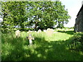
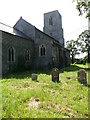
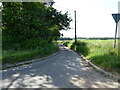
Suffield is a small civil parish located in the county of Suffolk, covering an area of 5.9 square kilometres. The neighbourhood is defined by its proximity to rural communities and its quiet character, making it a distinct choice for those seeking a slower pace of life away from major urban centres. Living in Suffield offers a setting where open spaces and established village patterns dominate the landscape. This civil parish provides a foundation for a traditional lifestyle, centred on local connections rather than the fast rhythm of city living. You will find that daily life here revolves around the immediate surroundings, with the entire community contained within a manageable footprint. The parish structure suggests a focus on local governance and community affairs, reinforcing the sense of neighbourhood identity. There are no cosmopolitan hubs or commercial high streets within the immediate limits of the parish, so your attention shifts to the natural environment and the villages that may border this specific land. For a homebuyer, this means finding a property in Suffield often involves looking at homes integrated into the fabric of the land rather than detached units in a commercial zone. The size of the area ensures that travel distances are short, though you should anticipate relying on established transport links located nearby for broader connectivity. Suffield remains a singular parish where the local imprint on the landscape is clear and the scale invites a deep sense of place.
- Area Type
- Parish
- Area Size
- 5.9 km²
- Population
- Not available
- Population Density
- Not available
Demographics
The demographic profile of Suffield reveals a community that has settled into a long-term residence pattern. Residents in this parish have an average median age of 70 years, indicating a population skewed significantly towards older adults. This age distribution shapes the local services and social activities, catering to the needs of retirees and those living into older age. The high level of stability in the community is reflected in the housing tenure data, where 79% of residents own their homes outright or with a mortgage. Such a high home ownership rate suggests that few people move in and out frequently; instead, families and individuals establish roots for decades. Household composition and accommodation types align with this settled demographic, favouring larger properties that can accommodate multiple occupants or serve as residences for extended periods. Diversity within the parish reflects the national pattern for rural England, with the predominant ethnic group categorised under total population statistics without specific breakdowns provided in the source data. Despite the homogeneity of age, the home ownership figures suggest a broad economic base where property couples with long-term residency. There are no indicators of significant deprivation affecting the quality of life, as the lack of data on specific deprivation indices implies that no major concentration of poverty exists to skew the profile. This demographic reality defines the social rhythm of Suffield, where neighbours are likely to share similar life stages and a commitment to the permanence of their homes.
Household Size
Accommodation Type
Tenure
Ethnic Group
Religion
Household Composition
Age
Household Deprivation
NS-SEC
Explore more demographic insights in this area
Go to Demographics tabPlanning
Planning Constraints
- Flood RiskPremium
- Ramsar Wetland SitesPremium
- Area of Outstanding Natural BeautyPremium
- Protected Nature ReservePremium
- Protected WoodlandPremium