Area Overview for Sudbury South West Ward
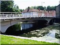
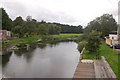
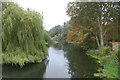
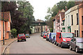
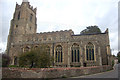
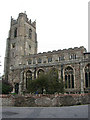
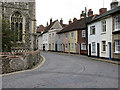
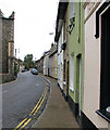
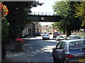
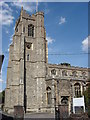
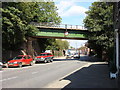
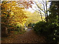
Photos of Sudbury South West Ward
Area Information
Sudbury South West Ward occupies a specific electoral district within the town of Sudbury, governed by Babergh District Council in the Eastern region of England. This compact area covers only 2.2 km², making it a small, defined neighbourhood rather than a sprawling suburban sprawl. You are looking at a ward that functions as a microcosm of the larger Sudbury community, situated near the coordinates 52.03425594255292, 0.7210425920368846. Living in Sudbury South West Ward means you are part of a tightly knit section of the town, surrounded by other wards including Sudbury North, South, South East, and East. The location places residents within the established fabric of Suffolk, offering proximity to local amenities typical of a market town. This ward represents a discrete segment of the town's population, distinct yet integrated into the broader urban landscape of Sudbury. Your daily life here is shaped by this tight geographic footprint, where boundaries are clear and the community operates with a sense of local cohesion. Unlike larger districts, the small size ensures that services and neighbours are very closely packed, creating an environment where the town centre is always within easy reach. You move through a space that is historically and administratively tied to the wider borough, providing stability for those who choose this specific pocket of Sudbury.
- Area Type
- District Borough Unitary Ward
- Area Size
- 2.2 km²
- Population
- Not available
- Population Density
- Not available
Demographics
The community profile of Sudbury South West Ward is defined by a notably older demographic structure. The median age for residents reaches 70 years, which is significantly higher than the national average. You are likely dealing with a population where the most common age group spans the total spectrum but weighted heavily towards seniors. This age profile shapes the character of the neighbourhood, influencing everything from local shop choices to community events. Home ownership stands at 55%, indicating that slightly more than a half of the residents own their properties outright or with a mortgage, while the remainder rent their accommodation. This splits the local market between established owners and tenants. The data does not specify predominant ethnic groups or religious affiliations in the provided figures, so these aspects remain undefined in the current dataset. The household composition is recorded as total, suggesting a mix of family units and single-person households typical for an area with such a high median age. When you consider living in Sudbury South West Ward, you must account for an environment where pensioners and retirees likely form the core of the social fabric. This demographic reality drives demand for specific local services and creates a quiet, settled atmosphere compared to younger, family-heavy districts. The high home ownership rate also suggests stability, with fewer transient residents moving through the area frequently.
Household Size
Accommodation Type
Tenure
Ethnic Group
Religion
Household Composition
Age
Household Deprivation
NS-SEC
Explore more demographic insights in this area
Go to Demographics tabPlanning
Planning Constraints
- Flood RiskPremium
- Ramsar Wetland SitesPremium
- Area of Outstanding Natural BeautyPremium
- Protected Nature ReservePremium
- Protected WoodlandPremium
- Crime RiskPremium