Area Overview for Sudbourne
Photos of Sudbourne


Area Information
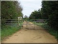
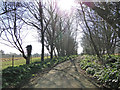
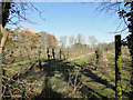
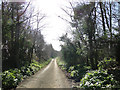
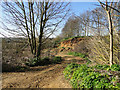
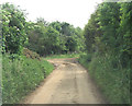
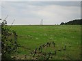
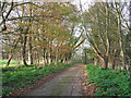
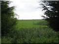
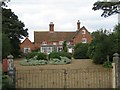
Sudbourne is a civil parish located in Suffolk Coastal District, sitting approximately two miles north of Orford. The parish covers 21.4 square kilometres, an area where the landscape includes significant water features. As of 2011, the population stood at 309 residents. This relatively small community lives in a setting that blends coastal history with medieval heritage. You find Sudbourne Hall, rebuilt by architect James Wyatt in 1784, standing near a church that dates from the 14th century. Aboveground, the area includes Captain's Wood, a 62-hectare nature reserve managed by the Suffolk Wildlife Trust. Daily life here revolves around a tight-knit village feel without the pressure of a larger town centre. The elevation sits at 62 feet, offering views of the surrounding countryside. Living in Sudbourne means being close to the coast while remaining within walking distance of the village amenities. You are situated in a parish that has remained largely untouched by modern sprawl. The nearest railway station is Aldborough, located about 4½ miles away. This distance requires careful planning if you rely on public transport for your commute. The area retains its character through listed buildings and historic estates, making it distinct from other parts of East Anglia.
- Area Type
- Parish
- Area Size
- 21.4 km²
- Population
- Not available
- Population Density
- Not available
Demographics
The community in Sudbourne is defined by an older demographic profile. The median age is 70 years old, indicating that the most common residents are in their senior years. This suggests a population where many people are already retired or spending their later life stages in the parish. Home ownership stands at 69 per cent of the total households. This high figure suggests that property here is primarily owned rather than rented. When you look at household composition and accommodation type data, the picture reinforces a settled, stable community where families have long-term ties to the land. The demographic data does not specify breakdowns for ethnicity, religion, or specific age ranges, so the focus remains on the overall age median and ownership status. Living in this area likely means interacting with a cohort that prioritises stability over transience. You are part of a neighbourhood where a significant majority of adults own their homes outright or with a mortgage. This level of ownership often correlates with residents who are less likely to move frequently. The community reflects a quiet existence where the average resident is considerably older than the national UK average.
Household Size
Accommodation Type
Tenure
Ethnic Group
Religion
Household Composition
Age
Household Deprivation
NS-SEC
Explore more demographic insights in this area
Go to Demographics tabPlanning
Planning Constraints
- Flood RiskPremium
- Ramsar Wetland SitesPremium
- Area of Outstanding Natural BeautyPremium
- Protected Nature ReservePremium
- Protected WoodlandPremium
- Crime RiskPremium