Area Overview for Stratford St Mary
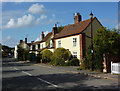
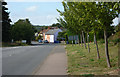
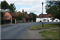
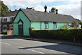
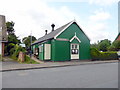
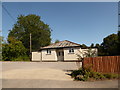
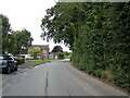
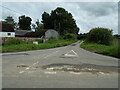
Photos of Stratford St Mary


Area Information
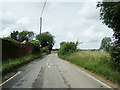
Stratford St Mary is a compact built-up area spanning 41.6 hectares, nestled in the heart of England. With a median age of 70, it is a community predominantly shaped by older residents, many of whom may be retired or long-established in the area. The high home ownership rate of 82% suggests a stable, rooted population, with many properties likely passed down through generations. Daily life here is characterised by proximity to key services: three railway stations—Manningtree, Mistley, and Colchester—offer easy access to nearby towns, while the area’s digital connectivity is among the best in the region, with a broadband score of 100. Stratford St Mary Primary School, rated ‘good’ by Ofsted, serves the local community, and the area’s low crime risk score of 84/100 reinforces its appeal as a safe, low-stress environment. For those seeking a quiet, well-connected home near Colchester, Stratford St Mary offers a blend of practicality and tranquility, with its modest size ensuring a close-knit feel.
- Area Type
- Built Up Area 250
- Area Size
- 41.6 hectares
- Population
- Not available
- Population Density
- Not available
Stratford St Mary offers a mix of retail and transport amenities within practical reach. The area includes five retail outlets, notably three branches of the East of England Co-operative Co, which may provide essential shopping and local services. These stores likely cater to daily needs, offering a range of products and community-focused services. The three nearby railway stations—Manningtree, Mistley, and Colchester—enhance accessibility, connecting residents to broader networks for commuting, shopping, or leisure. While the data does not specify parks or leisure facilities, the presence of multiple retail and transport options suggests a functional, service-oriented lifestyle. The compact size of the area means amenities are within walking or short driving distance, fostering convenience and a sense of local cohesion.
Amenities
Schools
Stratford St Mary Primary School is the only named school within the area, serving the local community with a ‘good’ Ofsted rating. As a primary school, it caters to younger children, providing a foundation for education in the area. The absence of secondary schools or other educational institutions in the immediate vicinity means families may need to consider commuting to nearby towns like Colchester for further schooling. However, the quality of the primary school is a positive factor for those prioritising early education. The school’s rating suggests a focus on effective teaching and student outcomes, which could be a draw for families seeking reliable local education. The limited range of school types reflects the area’s smaller scale, but the existing institution is a key asset for residents with young children.
| Rank | School | Type | Entry gender | Ages |
|---|
Explore more schools in this area
Go to Schools tabDemographics
The population of Stratford St Mary skews heavily towards older age groups, with a median age of 70. This suggests a community where retirees and long-term residents dominate, potentially influencing local services and amenities. Home ownership is exceptionally high at 82%, indicating that most residents live in properties they own, which may contribute to a sense of permanence and stability. The data does not specify household composition or accommodation types, but the high home ownership rate implies a mix of family homes, semi-detached properties, or older housing stock. The area’s demographic profile, while not detailed in terms of ethnic or religious diversity, aligns with broader trends in rural or semi-urban areas where older populations are more prevalent. This age profile may shape the local economy, with services tailored to mature residents, such as healthcare access and leisure activities.
Household Size
Accommodation Type
Tenure
Ethnic Group
Religion
Household Composition
Age
Household Deprivation
NS-SEC
Explore more demographic insights in this area
Go to Demographics tabPlanning
Planning Constraints
- Crime RiskPremium