Area Overview for Stow Bedon and Breckles
Photos of Stow Bedon and Breckles

Area Information
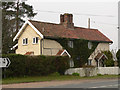
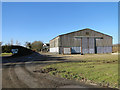
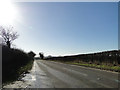
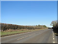
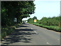
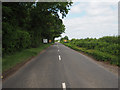
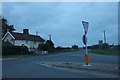
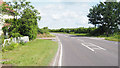
Living in Stow Bedon and Breckles means inhabiting a compact civil parish defined by a landscape of 13.7 km². You will find yourself in a very small community where the built environment blends tightly with the surrounding countryside. The area operates without the constraints of major protected sites, as it contains no Ramsar wetland coverage or Area of Outstanding Natural Beauty status. However, you must account for the presence of protected nature reserves and protected woodland within the parish boundaries. These designations act as planning constraints, potentially limiting new development and maintaining the rural character of the location. Most residents live in properties they own outright rather than rent, creating a stable environment where ownership is the norm. The demographic profile shows a significant proportion of older residents, with a median age of 70 years. This suggests a community driven by retirees and established families rather than young professionals. Safety is a strong point for those considering homes in Stow Bedon and Breckles, with crime rates sitting well below the national average. You are looking at an area with high ownership rates and a quiet, aged population, making it suitable for those seeking a settled rural life away from urban congestion.
- Area Type
- Parish
- Area Size
- 13.7 km²
- Population
- Not available
- Population Density
- Not available
Demographics
The community within the parish of Stow Bedon and Breckles reflects an older population profile, characterized by a median age of 70 years. This high median age indicates that most households consist of retirees or older residents who have long-term ties to the locality. The age distribution leans heavily towards the "Age: Total" category, suggesting a low influx of younger working families moving into the area. This demographic reality shapes the local services and social culture, focusing on the needs of pensioners and mature residents. Home ownership defines the social fabric here, with 77% of households owning their homes outright. This figure contrasts sharply with rental markets found in city centres, indicating a settled population that has accumulated equity over decades. The high percentage of owner-occupied homes suggests stability and a lack of transient renting. While the data does not provide specific breakdowns by ethnicity or religion, the community remains predominantly consistent in its composition, mirroring the broader patterns of rural Norfolk parishes. For you, this means a neighbourhood where residents are likely to be permanent locals with deep roots. The lack of younger demographics means public transport options and amenities may cater specifically to the older age bracket rather than a mixed-age workforce.
Household Size
Accommodation Type
Tenure
Ethnic Group
Religion
Household Composition
Age
Household Deprivation
NS-SEC
Explore more demographic insights in this area
Go to Demographics tabPlanning
Planning Constraints
- Flood RiskPremium
- Ramsar Wetland SitesPremium
- Area of Outstanding Natural BeautyPremium
- Protected Nature ReservePremium
- Protected WoodlandPremium
- Crime RiskPremium