Area Overview for Stow Bardolph
Photos of Stow Bardolph

Area Information
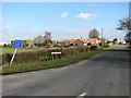
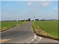
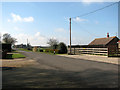
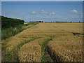
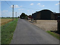
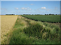
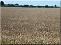
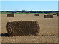
Stow Bardolph stands as a civil parish covering an area of 24.7 km² in the county of England. Living in Stow Bardolph presents a quiet, established character defined by its size and exclusivity as a single parish boundary. The locality does not share borders with other named administrative units within the provided information, focusing instead on its own distinct footprint. Daily life here revolves around the specific limitations of a rural parish where the physical landscape dominates the social experience. This is not a sprawling settlement but a defined geographical unit where residents navigate the 24.7 square kilometres of territory. For those researching homes in Stow Bardolph, the area offers a contained environment without complex neighbouring jurisdictions to consider. The sense of place is rooted in these clear geographical boundaries and the specific rural nature of the English countryside. Buyers seeking a property within this parish should expect a setting where the land itself is a primary feature of the living experience.
- Area Type
- Parish
- Area Size
- 24.7 km²
- Population
- Not available
- Population Density
- Not available
Demographics
The community profile of Stow Bardolph reveals significant demographic shifts typical of rural English parishes. The median age sits at 70 years, indicating an older population where living in Stow Bardolph often reflects retirement or later adulthood stages. Age data identifies "Age: Total" as the reporting metric, without further breakdowns into younger cohorts. Home ownership stands at a solid 74%, which suggests a stable financial base among residents rather than a transient renting population. Most households operate as single ownership units given the high percentage quoted. Accommodation type records show only a total figure is available, meaning specific details on flats or character homes remain unconfirmed in the current records. The area displays a clear demographic skew toward older age groups compared to national averages. You will find few families with young children if the median age is accurate. Buying a home in this neighbourhood means joining a community where the average resident is significantly older than the national population mean. Diversity metrics and specific household compositions are not detailed beyond the aggregate total, so you should rely on the age and ownership figures that are confirmed.
Household Size
Accommodation Type
Tenure
Ethnic Group
Religion
Household Composition
Age
Household Deprivation
NS-SEC
Explore more demographic insights in this area
Go to Demographics tabPlanning
Planning Constraints
- Flood RiskPremium
- Ramsar Wetland SitesPremium
- Area of Outstanding Natural BeautyPremium
- Protected Nature ReservePremium
- Protected WoodlandPremium
- Crime RiskPremium