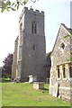
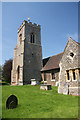
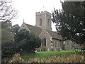
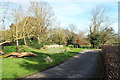
Area Overview for Stour Ward
Photos of Stour Ward
Area Information
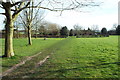
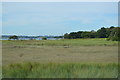
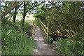
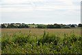
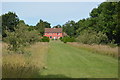
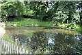
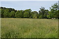
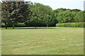
Stour Ward occupies a significant section of the landscape covering 32.2 square kilometres in England. This district offers a distinct environment where residents navigate a mix of open spaces and established residential zones. The area is defined by its generous size compared to typical urban flats, providing ample room for different lifestyles to take root. Living in Stour Ward means engaging with a space where infill sites and conservation areas coexist, shaping the daily rhythm of life for those who call this ward home. The ward functions as a self-contained unit within the broader geography, offering a tangible sense of place without the congestion often found in smaller wards. You will find that the character of this location is woven from its physical footprint rather than transient trends. The scale of 32.2 square kilometres provides sufficient breadth for independent living while maintaining proximity to surrounding amenities. Those considering homes in Stour Ward appreciate this balance, as the area avoids the intense density found in city centres. The experience here is grounded in the specific contours of the land itself.
- Area Type
- District Borough Unitary Ward
- Area Size
- 32.2 km²
- Population
- Not available
- Population Density
- Not available
Demographics
The community within Stour Ward shows a pronounced demographic skew towards older residents. Data indicates a median age of exactly 70 years, which defines the social fabric of this district. The most common age range shows a concentration across the total population, reinforcing the profile of a mature neighbourhood. Over 74 percent of households report owning their property outright, a figure that significantly exceeds the average for many modern districts. This high level of home ownership suggests long-term stability within the community. Households are composed of individuals who have settled into the area for the duration of their lives. The accommodation types reflect this permanence, with a focus on established dwellings rather than transient rentals. There is no recorded presence of protected nature reserves or nature reserves within the ward boundaries, indicating a landscape that has developed without specific nature conservation overlays. The population diversity data remains total across the board, reflecting the established make-up of the area. For those studying schools near Stour Ward, the age profile suggests a lower demand for primary education compared to younger family-heavy zones. Instead, the area serves those seeking a retirement-focused environment or a quiet place to age gracefully.
Household Size
Accommodation Type
Tenure
Ethnic Group
Religion
Household Composition
Age
Household Deprivation
NS-SEC
Explore more demographic insights in this area
Go to Demographics tabPlanning
Planning Constraints
- Flood RiskPremium
- Ramsar Wetland SitesPremium
- Area of Outstanding Natural BeautyPremium
- Protected Nature ReservePremium
- Protected WoodlandPremium
- Crime RiskPremium