Area Overview for Stour Valley North Ward
Photos of Stour Valley North Ward

Area Information
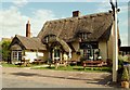
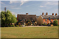
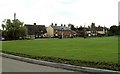
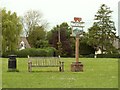
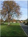
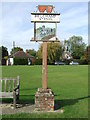
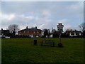
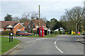
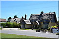
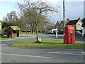
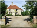
Stour Valley North Ward stands as a distinct electoral ward within Braintree District, located in the northern reaches of Essex. The area covers a substantial expanse of 70.6 km², bordering neighbouring districts such as West Suffolk and Babergh. You will find yourself in a locality defined by clear administrative boundaries set by the Office for National Statistics. This ward sits at coordinates 52.05123243474425, 0.6150806402529329, positioning it firmly in the East of England region. Your daily routine here will be shaped by this rural yet administratively organised setting. The name Stour Valley North Ward reflects its specific identity within a larger non-metropolitan district structure. You are not in a city centre or a dense urban sprawl, but rather in a defined ward with its own characteristics. This geographical context matters if you plan to commute or access local services. The area represents a specific slice of the rural Essex landscape that balances rural quiet with necessary district-level infrastructure support. When you look at living in Stour Valley North Ward, you are choosing a space with significant square footage of land, distinct from its immediate neighbours to the west and south.
- Area Type
- District Borough Unitary Ward
- Area Size
- 70.6 km²
- Population
- Not available
- Population Density
- Not available
Demographics
The community character of Stour Valley North Ward is defined by a very specific age profile. Data confirms that the median age for residents is 70 years old. This indicates a neighbourhood where the predominant demographic is senior citizens living in retirement or enjoying their later years. You are looking at an area where the most common age range is classified as Age: Total, reflecting this high average without providing a narrower bracket in the available records. The social fabric is heavily weighted towards older generations, which shapes local shop habits, community events, and school utilisation. Homeownership is a defining feature of this demographic, with 76% of households owning their homes. This high ownership rate suggests long-term residents who have settled into the area rather than short-term tenants or commuters renting temporarily. You will find established families or downsizers rather than a transient population. The ward does not present data on predominant ethnicity, religion, or detailed household composition breakdowns, meaning the narrative focuses on stability and age. Living in Stour Valley North Ward means joining a community where legacy ownership is the norm. The lack of young families is evident in the low household counts typical of such age profiles. This demographic reality dictates the pace of life and the types of amenities that might thrive here.
Household Size
Accommodation Type
Tenure
Ethnic Group
Religion
Household Composition
Age
Household Deprivation
NS-SEC
Explore more demographic insights in this area
Go to Demographics tabPlanning
Planning Constraints
- Flood RiskPremium
- Ramsar Wetland SitesPremium
- Area of Outstanding Natural BeautyPremium
- Protected Nature ReservePremium
- Protected WoodlandPremium
- Crime RiskPremium