Area Overview for Stopsley Ward
Photos of Stopsley Ward
Area Information
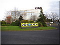
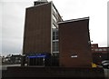
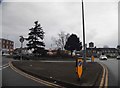
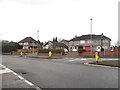
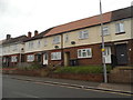
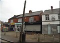
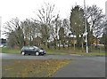
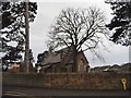
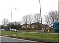
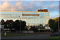
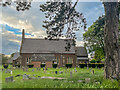
Living in Stopsley Ward offers a defined suburban experience within the north-east of Luton, Bedfordshire, England. This ward covers an area size of 4.2 km² and is characterised by residential development supported by local services. The centre of the suburb revolves around a village church, maintaining a village-like character despite its urban setting. Residents benefit from the presence of Stopsley Community Primary School and a nearby fire station, which contribute to local infrastructure. The skyline is dominated by Jansel House, an office block built in 1961 that houses the Luton VAT office above a parade of shops at street level. According to the 2021 Census, the ward had a population of 12,544 residents. Estimates suggest this number rose to around 12,702 as of June 2024, indicating a modest growth in the local population. The area sits at an elevation of 515 feet or 157 metres. Historically, the name Stopsley derives from Old English elements dating between AD 750 and AD 950. The original record described it as 'Stoppeslegh in Soca de Luton'. Most of the urbanised part of the civil parish became part of Luton when boundaries were extended in 1933. For those considering homes in this district, the layout offers a mix of historical depth and modern commercial functionality. You can expect a neighbourhood bounded by the edge of Luton to the north, Vauxhall Way to the south, and Bradgers Hill to the west.
- Area Type
- District Borough Unitary Ward
- Area Size
- 4.2 km²
- Population
- 2850
- Population Density
- 671 people/km²
Demographics
The community in Stopsley Ward displays a distinct age profile with a median age of 70 years. This figure paints a clear picture of an area with a significant older resident population. The data lists the most common age range simply as "Age: Total", which indicates the dataset aggregates ages rather than specifying younger cohorts. Consequently, prospective buyers should understand that the area is not primarily designed for families with young children or students. The demographic composition leans heavily toward retirement living or older homeowners who value a quieter environment. Home ownership levels in Stopsley Ward are exceptionally high, standing at 70 per cent of the total population. This statistic suggests that the vast majority of residents own their homes outright or through a mortgage. The household composition data reflects the overall total for the area, reinforcing the stability found among long-term owners. Accommodation type records also show a total figure, implying a consistent housing stock rather than a rapid turnover of rental properties. Ethnically and religiously, the ward presents data where predominant groups and religious affiliations are listed as totals. This likely points to a community with established, traditional values rather than rapid recent migration or significant shifts in faith. For anyone looking to live here, you will find a neighbourhood defined by its mature residents and stable ownership rates rather than transient population turnover.
Household Size
Accommodation Type
Tenure
Ethnic Group
Religion
Household Composition
Age
Household Deprivation
NS-SEC
Explore more demographic insights in this area
Go to Demographics tabPlanning
Planning Constraints
- Flood RiskPremium
- Ramsar Wetland SitesPremium
- Area of Outstanding Natural BeautyPremium
- Protected Nature ReservePremium
- Protected WoodlandPremium
- Crime RiskPremium