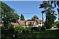
Area Overview for Stonham Aspal
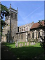
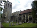
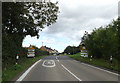
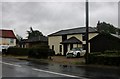
Photos of Stonham Aspal


Area Information
Stonham Aspal is a compact built-up area in England, covering 43.4 hectares. Its population, while not specified in exact numbers, is characterised by a median age of 70, suggesting a community skewed towards older residents. The area is predominantly owner-occupied, with 80% of homes in private hands, indicating a stable housing market. Daily life here is shaped by proximity to key amenities: a primary school with a good Ofsted rating, retail outlets including a Co-op and petrol stations, and rail access via Needham Market and Stowmarket stations. The low crime risk score of 82 further reinforces its appeal as a secure place to live. While the area’s size is modest, its infrastructure supports practical living, with local shops and transport links within easy reach. For those seeking a quiet, well-connected community with established services, Stonham Aspal offers a blend of convenience and tranquillity.
- Area Type
- Built Up Area 250
- Area Size
- 43.4 hectares
- Population
- Not available
- Population Density
- Not available
The lifestyle in Stonham Aspal is supported by nearby amenities, including five retail outlets such as East of England Co-operative Co and Co-op Petrol stations. These shops cater to daily essentials, ensuring residents have access to convenience stores and fuel services. The area’s rail connections to Needham Market and Stowmarket stations provide opportunities for commuting or leisure travel. While the data does not specify parks or leisure facilities, the presence of retail and transport options suggests a practical, community-focused lifestyle. The mix of shops and rail access contributes to a self-sufficient environment, ideal for those prioritising ease of access over large-scale leisure options.
Amenities
Schools
The primary school closest to Stonham Aspal is the Stonham Aspal Church of England Voluntary Aided Primary School, which holds a good Ofsted rating. This school serves the local community, offering education for younger residents. The absence of secondary schools in the data means families may need to look further afield for secondary education, but the primary school’s strong rating provides reassurance for parents prioritising quality early education. The presence of a single primary school suggests a focused educational environment, though it does not indicate the availability of other schools or specialist facilities.
| Rank | School | Type | Entry gender | Ages |
|---|
Explore more schools in this area
Go to Schools tabDemographics
The population of Stonham Aspal has a median age of 70, reflecting a community where older residents dominate. The most common age range is listed as “Age: Total,” which may indicate aggregated data but aligns with the high median age. Home ownership stands at 80%, suggesting a majority of residents live in properties they own, rather than renting. The data does not specify household composition or accommodation types, but the overall demographic profile points to a mature population with established living arrangements. The area’s demographics do not include breakdowns for ethnic groups or religions, so these aspects remain unquantified. The high home ownership rate and older age profile may influence local services, with a focus on healthcare and community support.
Household Size
Accommodation Type
Tenure
Ethnic Group
Religion
Household Composition
Age
Household Deprivation
NS-SEC
Explore more demographic insights in this area
Go to Demographics tabPlanning
Planning Constraints
- Crime RiskPremium