Area Overview for Stonham Ward
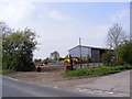
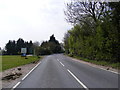
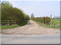
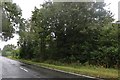
Photos of Stonham Ward

Area Information
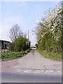
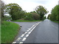
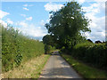
Living in Stonham Ward offers a established residential experience within the district of Norfolk. This ward covers a significant landmass of 62.7 km², providing ample space for those seeking room to breathe. The area represents a mature community where daily life revolves around a deep sense of stability and long-term settlement. Prospective buyers looking at homes in Stonham Ward are entering an environment defined by quiet streets and a established rhythm. The large size of the ward suggests a diversity of street patterns and distances between local amenities, which can affect how you structure your day. You are moving into a region that functions independently yet connects with the wider local landscape. The character here is one of permanence, where residents have likely put down roots for decades. Understanding the scale of 62.7 km² helps you appreciate the distances involved when commuting or visiting services outside the immediate neighbourhood. Whether you value open countryside or established hamlets, the physical footprint of Stonham Ward provides the context for your lifestyle choices. You become part of a larger grid where property values reflect years of history rather than transient trends.
- Area Type
- District Borough Unitary Ward
- Area Size
- 62.7 km²
- Population
- Not available
- Population Density
- Not available
Demographics
The community in Stonham Ward is distinctly older than the national average, with a median age of 70 years. This demographic profile indicates a neighbourhood favoured by retirees and those seeking a quieter retirement lifestyle. The household composition and accommodation types reflect a population that has settled permanently in this region. Home ownership stands at an impressive 83%, confirming that the vast majority of residents own their property outright. This high level of ownership suggests a stable community where families have built equity over many years. The age distribution points to a shrubbery demographic where younger working families may be less common than older couples or singles. You should expect neighbours who have lived here for a long time and value tradition. The lack of specific data on ethnicity or religion means you cannot quantify diversity levels, but the high ownership rate speaks to a long-standing local population. Living in Stonham Ward means engaging with a community where life pace slows as residents age. The demographic weight on older age groups shapes local demand for healthcare and social services rather than schools or nightlife. This is a neighbourhood built for longevity and stability.
Household Size
Accommodation Type
Tenure
Ethnic Group
Religion
Household Composition
Age
Household Deprivation
NS-SEC
Explore more demographic insights in this area
Go to Demographics tabPlanning
Planning Constraints
- Flood RiskPremium
- Ramsar Wetland SitesPremium
- Area of Outstanding Natural BeautyPremium
- Protected Nature ReservePremium
- Protected WoodlandPremium
- Crime RiskPremium