Area Overview for Stody Ward
Photos of Stody Ward


Area Information
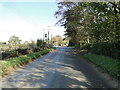
Stody Ward serves as a district council ward within North Norfolk District Council. It encompasses the civil parish of Stody, a small village situated approximately 4.1 miles south-west of Holt. The ward covers a total area of 53.9 km², placing residents 13.2 miles west-south-west of Cromer and 21.8 miles north-north-west of Norwich. Historical records describe the parish as having 1,277 acres within the Erpingham district. This location near coordinates 52.87291°N 1.05409°E offers a quiet rural setting for those seeking homes in Stody Ward. Daily life revolves around proximity to Holt and access to broader Norfolk amenities. Travel is facilitated by the nearest railway station at Sheringham on the Bittern Line, which connects Sheringham, Cromer, and Norwich. Norwich International Airport acts as the closest airport for regional travel. Living in Stody Ward means embracing a lifestyle defined by its distinct countryside character and historical significance. The area functions as a tranquil residential zone unaffected by major urban sprawl. You can find specific vibrancy in local village life while maintaining easy access to transport links for commuting to larger towns.
- Area Type
- District Borough Unitary Ward
- Area Size
- 53.9 km²
- Population
- Not available
- Population Density
- Not available
Demographics
The community profile for Stody Ward relies on specific historical and geographical data rather than modern census aggregates. Records indicate the parish contained 1,277 acres of land as noted in historical gazetteers. The population centre is the village of Stody, which has served as the local administrative hub for the ward. This small community sits at coordinates 52.87291°N 1.05409°E, influencing the density and type of households that reside there. Limited demographic data points to the area's nature as a sparsely populated rural ward. The primary residents have long ties to the 1,277 acres of historic land. Households in this region typically comprise families or individuals seeking the stability of village living. Accommodation types reflect the civil parish of Stody's establishment as a defined geographic entity within North Norfolk. The lack of detailed age profiles suggests no significant population influx, pointing to a steady demographic. Living in Stody Ward offers a community where residents are bound by shared historical geography and proximity to Holt.
Household Size
Accommodation Type
Tenure
Ethnic Group
Religion
Household Composition
Age
Household Deprivation
NS-SEC
Explore more demographic insights in this area
Go to Demographics tabPlanning
Planning Constraints
- Flood RiskPremium
- Ramsar Wetland SitesPremium
- Area of Outstanding Natural BeautyPremium
- Protected Nature ReservePremium
- Protected WoodlandPremium
- Crime RiskPremium