Area Overview for Stisted
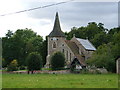
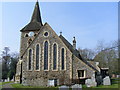
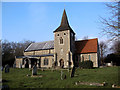
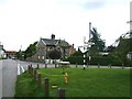
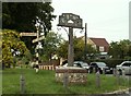
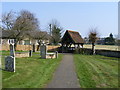
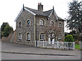
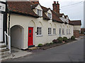
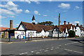
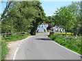
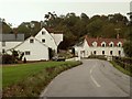
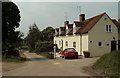
Photos of Stisted
Area Information
Stisted is a compact built-up area in England, covering 22.4 hectares, with a population characterised by a median age of 70. This suggests a community that may lean towards older residents, though the data does not specify generational breakdowns. The area’s proximity to Braintree and its surrounding infrastructure makes it a practical choice for those seeking a balance between rural tranquillity and accessible services. Daily life in Stisted is shaped by its modest size and the presence of key amenities, including retail outlets like Tesco Braintree and nearby rail stations. The area’s appeal lies in its simplicity—fewer urban pressures, with essential services within reach. For homebuyers, Stisted offers a snapshot of a quieter lifestyle, though the relatively high median age may indicate a community with distinct needs and priorities. The presence of two primary schools, including one with an outstanding Ofsted rating, adds to its appeal for families. However, the area’s character is defined by its practicality, with transport links and digital connectivity supporting both local and commuting lifestyles.
- Area Type
- Built Up Area 250
- Area Size
- 22.4 hectares
- Population
- Not available
- Population Density
- Not available
Living in Stisted offers access to a range of amenities that support daily life. The area is within reach of five retail outlets, including Tesco Braintree and Co-op Petrol, ensuring convenience for shopping and fuel needs. Rail stations like Braintree Freeport and Cressing provide easy access to regional transport, while the nearby bus interchange adds flexibility for local travel. Though the data does not mention parks or leisure facilities, the presence of essential services suggests a practical lifestyle. The compact nature of Stisted means amenities are not overly spread out, making it efficient for residents to access shops, transport, and services. For those valuing simplicity and accessibility, the area’s amenities align with a low-maintenance, functional way of living.
Amenities
Schools
Stisted is served by two primary schools, both offering education for younger children. The Stisted Church of England Voluntary Aided Primary School provides a traditional educational setting, while the Stisted Church of England Primary Academy holds an outstanding Ofsted rating, indicating high standards in teaching and student outcomes. The presence of two primary schools ensures families have options, though the data does not mention secondary schools or other educational facilities. For parents, the outstanding rating at one school is a strong point, suggesting quality education is accessible. However, the absence of secondary school data means families may need to look beyond Stisted for comprehensive schooling. The mix of schools reflects a focus on early education, which aligns with the area’s demographic profile.
| Rank | A + A* % | School | Type | Entry gender | Ages |
|---|---|---|---|---|---|
| 1 | N/A | Stisted Church of England Voluntary Aided Primary School | primary | N/A | N/A |
| 2 | N/A | Stisted Church of England Primary Academy | primary | N/A | N/A |
Explore more schools in this area
Go to Schools tabDemographics
The population of Stisted has a median age of 70, with the most common age range categorised as "Age: Total," suggesting a broad but possibly older demographic. Home ownership stands at 73%, indicating a majority of residents live in properties they own, which may influence the local housing market’s dynamics. The data does not specify household composition or accommodation types, but the high home ownership rate implies a stable, long-term resident base. The absence of detailed figures on diversity or deprivation means the area’s social fabric remains less defined in the data. For those considering Stisted, the demographic profile suggests a community with a focus on established living, where the needs of older residents may be more prominent. This could translate into a quieter, less transient environment, though the practicality of services like rail stations and retail outlets ensures daily life remains functional.
Household Size
Accommodation Type
Tenure
Ethnic Group
Religion
Household Composition
Age
Household Deprivation
NS-SEC
Explore more demographic insights in this area
Go to Demographics tabPlanning
Planning Constraints
- Crime RiskLocked