Area Overview for Stevington
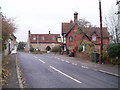
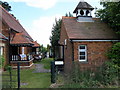
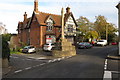
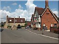
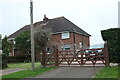
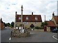
Photos of Stevington


Area Information
Stevington is a compact built-up area spanning 30.6 hectares, nestled in England. Its population, while not explicitly stated, reflects a median age of 70, suggesting a community skewed towards older residents. This area is defined by its practicality, with 81% of homes owned outright, indicating a stable, long-term resident base. Daily life here is shaped by proximity to essential services: three railway stations—Bedford, Bedford St Johns, and Kempston Hardwick—offer reliable links to nearby towns, while five retail outlets, including The Southern Co-operative Co and Tesco Clapham, provide convenience for everyday needs. Stevington’s character is one of quiet routine, where the low crime risk score of 90/100 underscores a safe, predictable environment. While the area lacks the vibrancy of larger cities, its simplicity and accessibility make it appealing for those prioritising security, ease of transport, and a low-maintenance lifestyle.
- Area Type
- Built Up Area 250
- Area Size
- 30.6 hectares
- Population
- Not available
- Population Density
- Not available
Residents of Stevington have access to a modest but functional range of amenities. Retail options include The Southern Co-operative Co, Budgens Clapham, and Tesco Clapham, offering everyday shopping needs within reach. The three railway stations—Bedford, Bedford St Johns, and Kempston Hardwick—provide regular service to nearby towns, facilitating travel for work, leisure, or social visits. While the area lacks parks or leisure facilities in the data, the presence of multiple retail and transport hubs suggests a lifestyle focused on convenience and connectivity. The absence of detailed information on dining or recreational options means these aspects remain unexplored, but the existing amenities support a basic, practical daily routine.
Amenities
Schools
| Rank | School | Type | Entry gender | Ages |
|---|
Explore more schools in this area
Go to Schools tabDemographics
Stevington’s population is predominantly older, with a median age of 70, reflecting a community where retirement is the norm. Home ownership is high, at 81%, suggesting most residents live in properties they own rather than rent. The data does not specify household composition or accommodation types, but the overall figures indicate a settled, mature demographic. Deprivation levels are not explicitly detailed, but the combination of high home ownership and low crime risk implies a relatively stable quality of life. The area’s demographic profile is homogenous, with no specific ethnic or religious breakdown provided, though the absence of diversity data means this remains an open question. For those seeking a retirement-focused environment with minimal social complexity, Stevington aligns with these characteristics.
Household Size
Accommodation Type
Tenure
Ethnic Group
Religion
Household Composition
Age
Household Deprivation
NS-SEC
Explore more demographic insights in this area
Go to Demographics tabPlanning
Planning Constraints
- Crime RiskPremium