Area Overview for Steppingley
Photos of Steppingley
Area Information
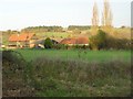
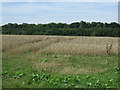
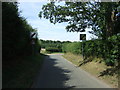
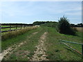
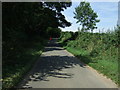
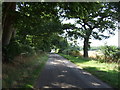
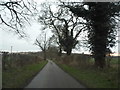
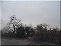
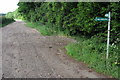
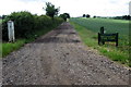
Steppingley is a civil parish located in England, covering an area of 5.3 km². This small settlement offers a distinct character defined by its rural setting and established community feel. The area sizes are modest, which often contributes to a quieter lifestyle compared with larger urban centres. You will find that daily life here revolves around local amenities and proximity to nearby towns rather than sprawling city infrastructure. The neighbourhood maintains a traditional footprint suitable for those seeking tranquility without complete isolation. Living in Steppingley means embracing a slower pace while retaining access to essential services found within reasonable travelling distance. The landscape includes natural features that define the boundary of the parish and influence the quality of the environment. Residents benefit from open spaces and greenery that are integral to the location's appeal. The community structure supports long-term living arrangements supported by high rates of home ownership. This setup creates stability for families and retirees alike who settle down for the long haul. Steppingley represents a practical choice for buyers prioritising space and peace over urban convenience. The area stands as a reliable option for anyone looking to purchase homes in a district with defined boundaries and a clear sense of place.
- Area Type
- Parish
- Area Size
- 5.3 km²
- Population
- Not available
- Population Density
- Not available
Demographics
The community profile of Steppingley reflects a mature demographic with a median age of 70 years. This statistic indicates that the population consists largely of older residents who have established roots in the locality. A significant majority of households own their properties, with 80 per cent of residents owning their homes outright or with a mortgage. This ownership level is substantially higher than national averages for comparable rural areas in England. The predominant age range aligns with retirement and semi-retirement years, suggesting a low dependency on youth-led services such as comprehensive pediatric healthcare close to the centre. Accommodation types in the parish cater primarily to family units or individuals seeking long-term stability. You will not find a high concentration of temporary housing or student accommodation within the 5.3 km² boundary. The social fabric is built around older traditions rather than transient living patterns. Diversity in terms of ethnicity and religion exists but follows the broader patterns seen in established English parishes without specific deviations from the rest of the county. This demographic makeup ensures a stable neighbourhood where residents know their neighbours and where community voices carry significant weight in local affairs. Buying here means joining a cohort of established homeowners rather than competing in a volatile rental market.
Household Size
Accommodation Type
Tenure
Ethnic Group
Religion
Household Composition
Age
Household Deprivation
NS-SEC
Explore more demographic insights in this area
Go to Demographics tabPlanning
Planning Constraints
- Flood RiskPremium
- Ramsar Wetland SitesPremium
- Area of Outstanding Natural BeautyPremium
- Protected Nature ReservePremium
- Protected WoodlandPremium
- Crime RiskPremium